We're fortunate to have more than 102 years of inlet history captured in photos, maps and documents.
The first photo gallery is an interactive, illustrated history of Sebastian Inlet across the decades. The second gallery builds on our original collection, sharing inlet history from 2021 to present.
The Sebastian Inlet District Commission gratefully acknowledges the efforts of Jim Culberson, former Sebastian Inlet District Commissioner and historian who conducted years of research and interviews to compile the historical archives that help tell the story of how the Sebastian Inlet came to be, including many of the images seen here.
To enlarge any images, right click the image and select "Open Image in New Tab".
.jpg?ixlib=rb-1.1.0&w=2000&h=2000&fit=max&or=0&s=33ccc9094337220be645ce36b724f09f)
This U.S. Geodetic Survey Map from 1880-81 shows “Gibson’s Cut” as a feature (next image). Combined with other material evidence, it is now known that D.P. Gibson was the first to attempt a "cut", and historians believe that first known attempt took place in 1872.
.jpg?ixlib=rb-1.1.0&w=2000&h=2000&fit=max&or=0&s=0d92aafef52501c6e66df8eae8ea82ed)
This U.S. Geodetic Survey Map drawn in the winter of 1880-81 shows “Gibson’s Cut” as a feature on the barrier island.

D.P. Gibson was a colorful character, known for unscrupulous land deals and selling land he didn't own. This March 1, 1882 Florida Star newspaper lists property for sale by Gibson.
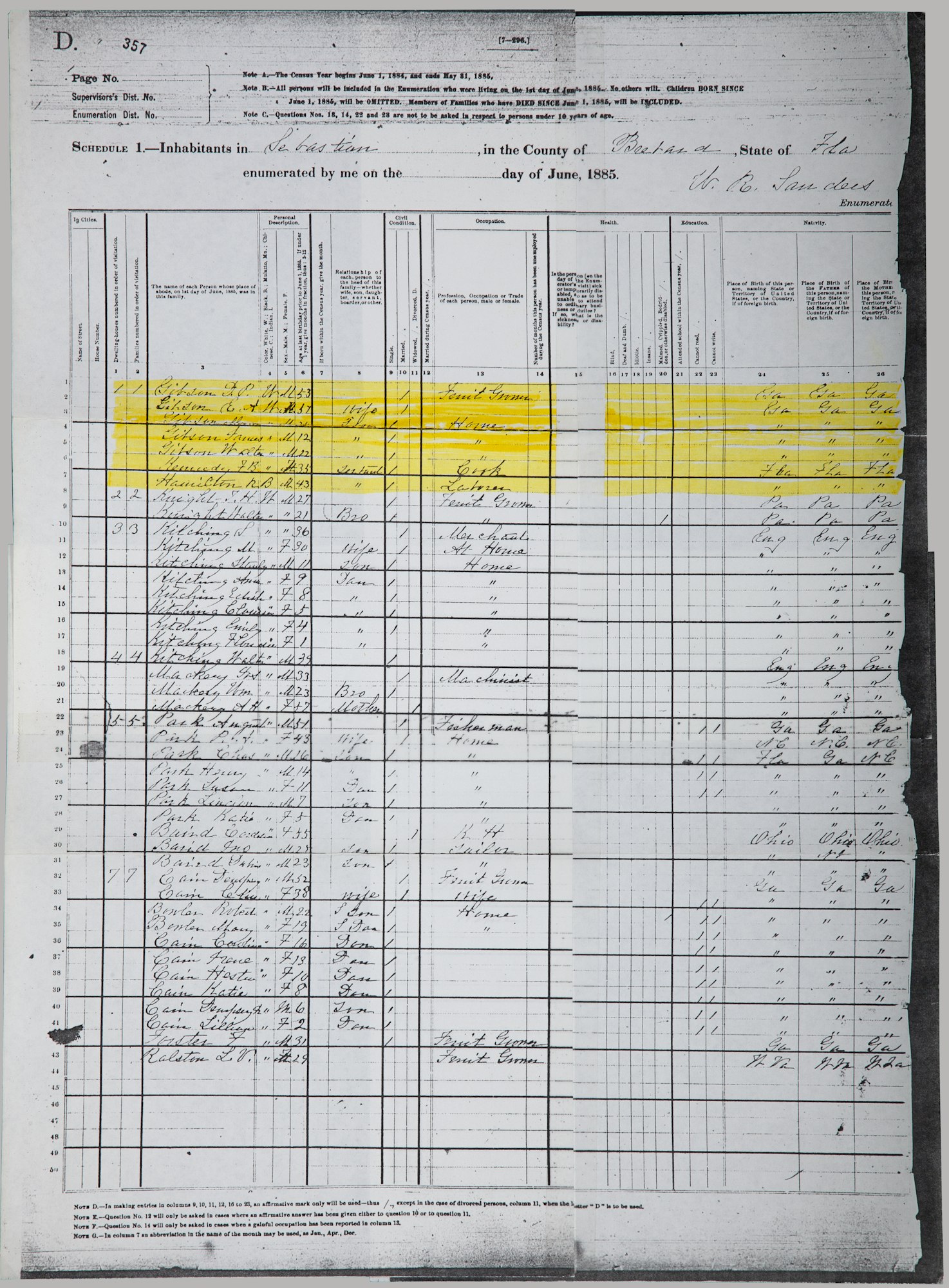
Included in the Sebastian Inlet District’s historical archives, a copy of the 1885 Census of the town of Sebastian that lists six heads of households with 23 adults and 16 children as residents of the small town. The very first name – D.P. Gibson.

A hand-drawn bathymetric survey by the U.S. Army Corps of Engineers, Jacksonville on September 11, 1905 noting Gibson’s Cut.
.jpg?ixlib=rb-1.1.0&w=2000&h=2000&fit=max&or=0&s=946e06c6dd91bad4c8825406c25e2abd)
At least six substantiated attempts to open a “cut” were made by 1905. Coinciding with that sixth attempt, Roy O. Couch (pictured here) moves to Brevard County and becomes the inlet's most outspoken champion.
.jpg?ixlib=rb-1.1.0&w=2000&h=2000&fit=max&or=0&s=5ac6a08c3207bfa523d77c5d2568215d)
After more than a decade of lobbying, Couch’s persistence paid off. On April 25, 1918, local residents in favor of an inlet formed the Sebastian Inlet Association.
.jpg?ixlib=rb-1.1.0&w=2000&h=2000&fit=max&or=0&s=a78e2a0b95247ee4256afa1702d12e14)
Couch built a six-inch suction dredge, hired Charles W. Sembler to dredge the cut. and the seventh attempt to open an inlet began. Shown here, first water flows through the inlet in late 1918.
.jpg?ixlib=rb-1.1.0&w=2000&h=2000&fit=max&or=0&s=c3b98ae5904b33abd463253f2f629c7d)
In late 1918, the first boat navigates the now open "cut" or inlet.

From the IRC Historical Society archives, local residents check on the progress of the inlet in January 1919.
.jpg?ixlib=rb-1.1.0&w=2000&h=2000&fit=max&or=0&s=8cbb25f20a97c41daea9162768bfdce6)
On May 23, 1919, the Sebastian Inlet District was formed by the Florida State Legislature with a charter of maintaining the navigation channel connecting the Indian River and the Atlantic Ocean. The new special district would take over for the Sebastian Inlet Association.
.jpg?ixlib=rb-1.1.0&w=2000&h=2000&fit=max&or=0&s=28893c79951252615dfe02a295a7d08c)
The inlet was once again opened in June of 1923. Shown here, a Ford Model-T converted by Roy O. Couch to haul the coquina rock for the jetties. The driver is identified as Rodney Kroegel.
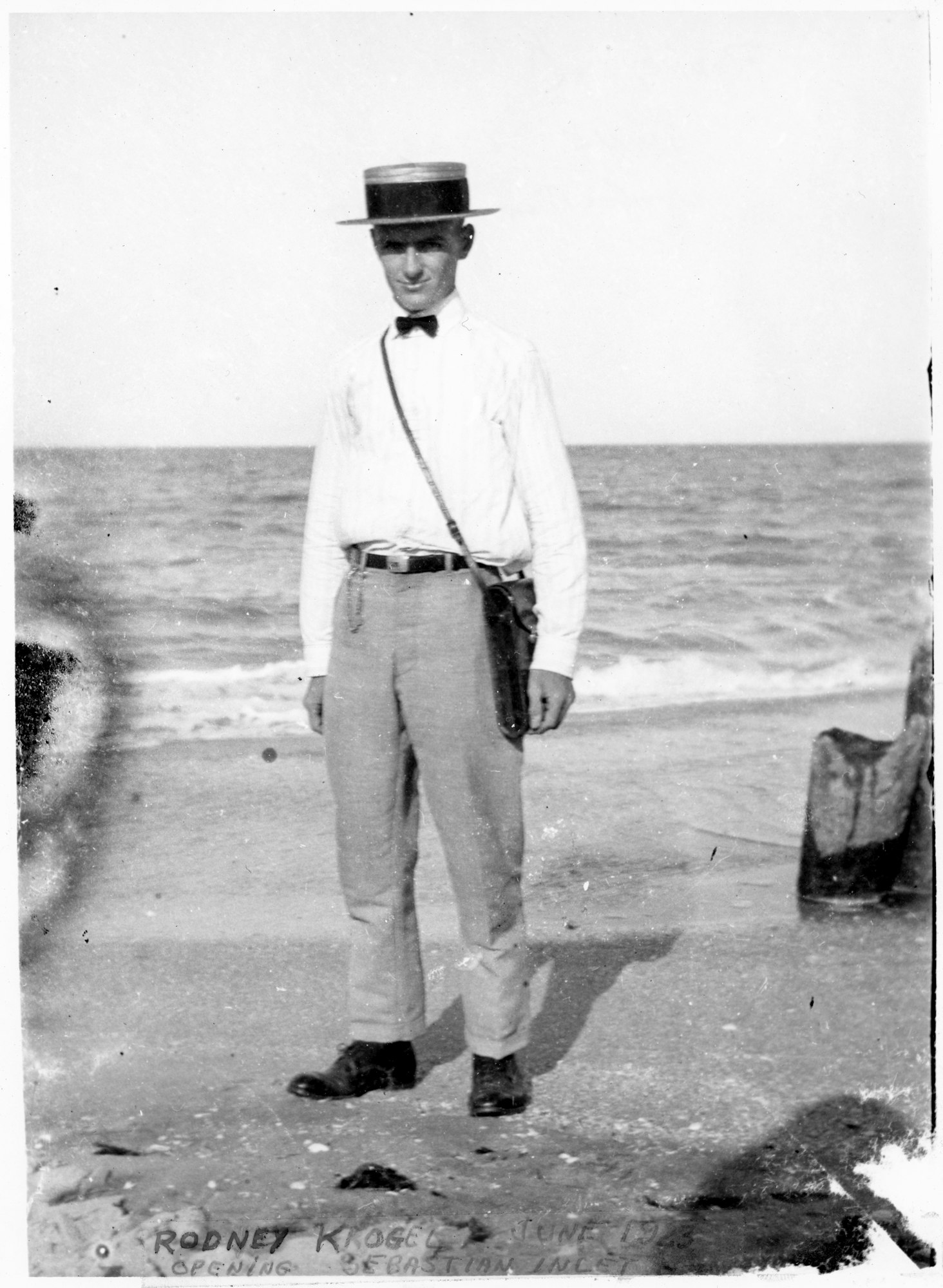
Pictured here Rodney Kroegel, son of Paul Kroegel, early settler of Sebastian and the first manager of Pelican Island National Wildlife Refuge after it’s creation by President Theodore Roosevelt in 1903.
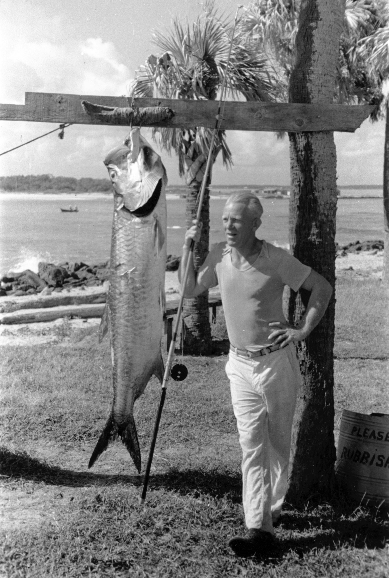
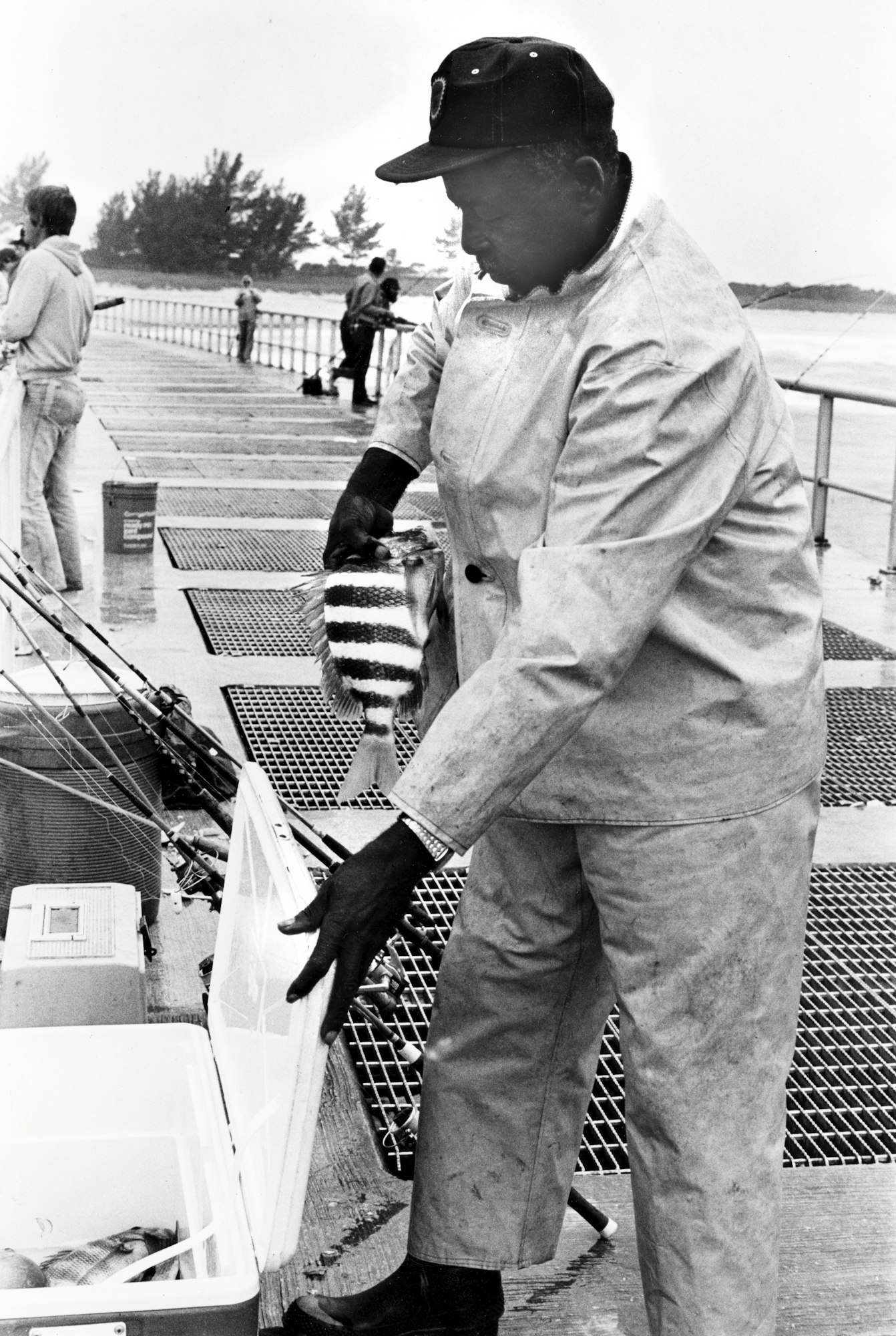
In the 1930s, the inlet became even more vital to the area’s survival. Subsistence fishing put food on the table for many local families, and commercial fishing was the lifeblood of the town of Sebastian. Shown here, a Robert Kempfer photo of a massive tarpon.
.jpg?ixlib=rb-1.1.0&w=2000&h=2000&fit=max&or=0&s=705b10c07a25d9577b31cff43646c58d)
The inlet also became a popular recreational area in the 1930s.
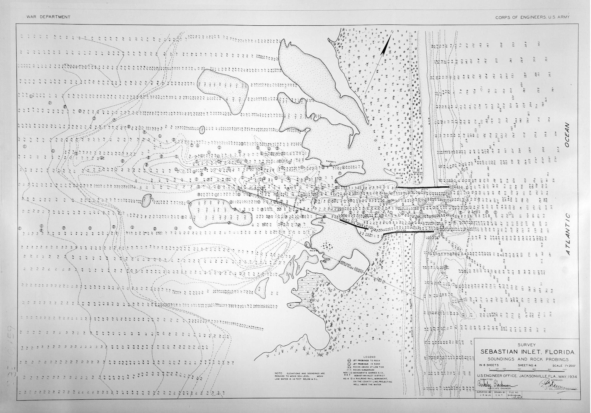
This May 1934 U.S. Army Corps of Engineers and War Department bathymetric survey of Sebastian Inlet and the surrounding area notes the steel bulkhead placed in the early 1930s to help maintain the inlet configuration. Remnants can still be seen today.

1938 photo by Robert Kempfer of Don Beaujean, who opened a popular fish camp on the North side of the inlet and went on to become a Commissioner for the Sebastian Inlet District, with friends Green Rodes and Helen Kempfer (L to R) by the north jetty.

Sebastian Inlet District Commissioners Roy O. Couch and Albert VorKeller give testimony to the War Department’s Board of Engineers for Rivers and Harbors in 1938, asking for assistance in reopening the now shoaled in Sebastian Inlet.
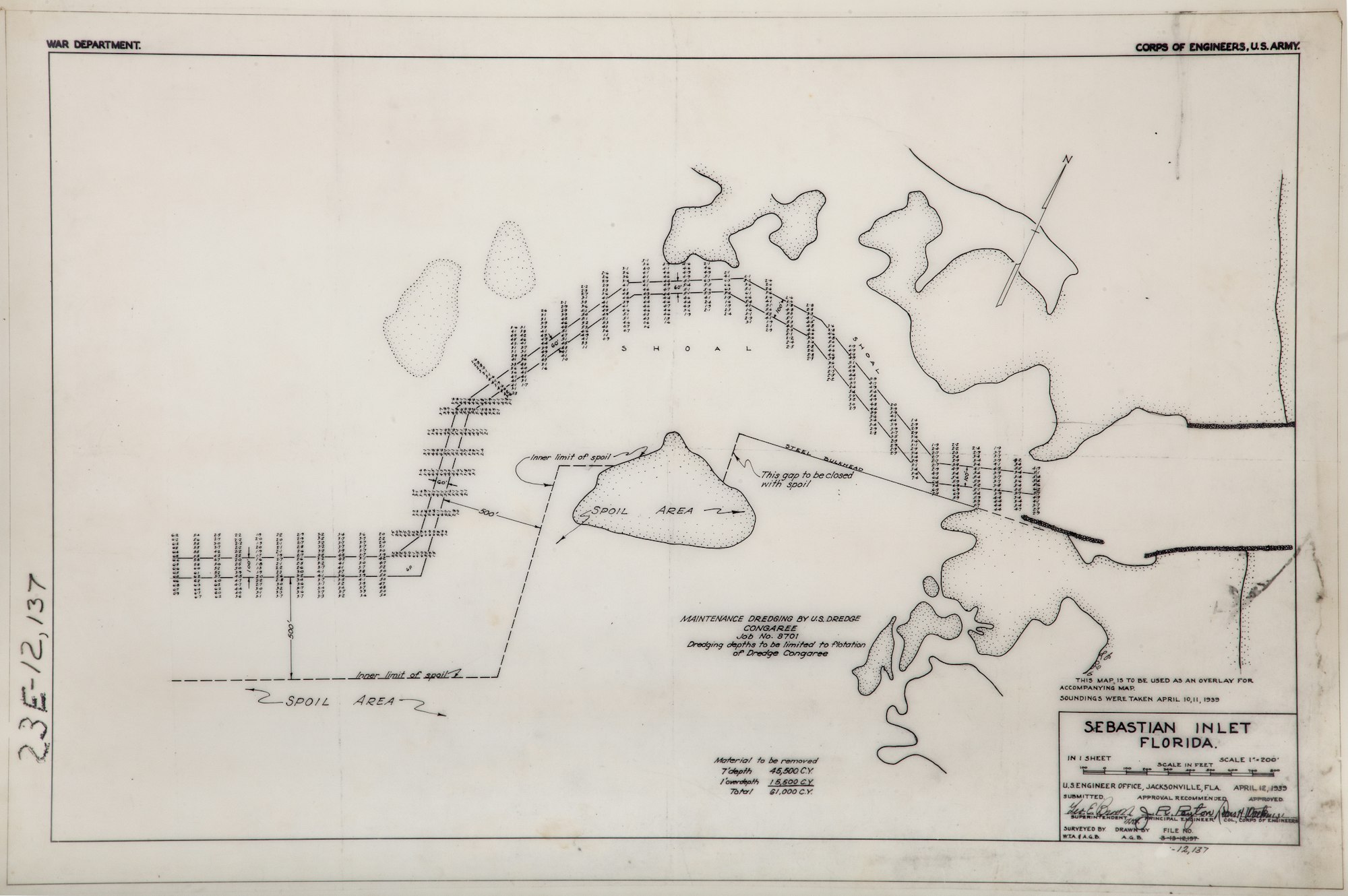
In 1939, the U.S. Army Corps of Engineers helps the Sebastian Inlet District open the now shoaled in inlet, sending the U.S. Dredge Congaree to remove the sediment. Shown here, the plans drawn for the channel maintenance dredging.
.jpg?ixlib=rb-1.1.0&w=2000&h=2000&fit=max&or=0&s=fe961fc0b24819d0f0294a7ddb24cbcd)
In April 1940, the U.S. Army Corps of Engineers completed a bathymetric survey of the now open inlet following the U.S. Dredge Congaree's work.

Shown here, an advertisement for Don Beaujean's Fish Camp from the November 15, 1940 edition of the Melbourne Times.

In 1941, the inlet was closed again by a strong Nor'Easter and remained closed through most of WW II for safety reasons. Towers built along the coast were manned by citizen spotters looking for German U-boats. This 1944 photo shows the inlet with a 14-foot dune and tower.
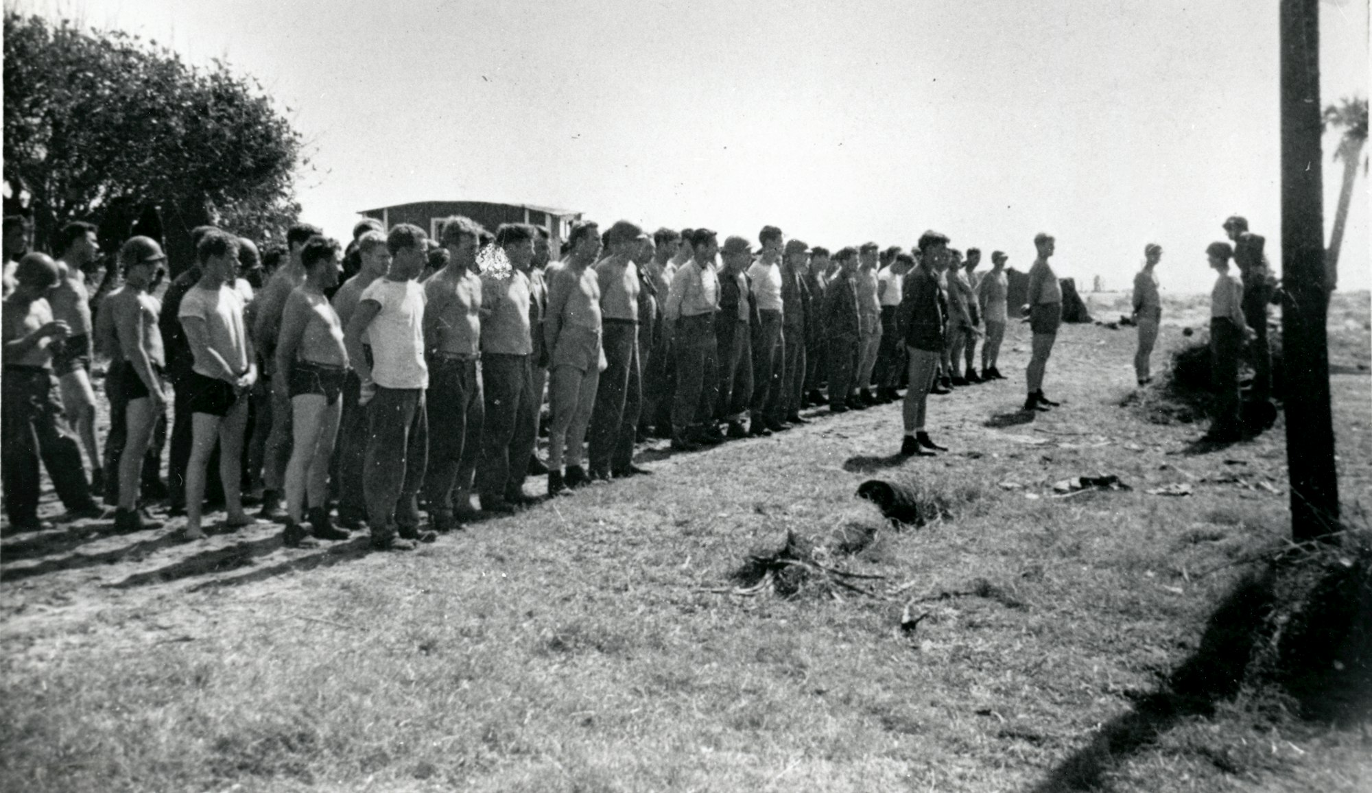
The inlet site was also turned over to the U.S. Navy as an amphibious training ground for their demolition squads. Pictured here, those U.S. Navy squads training in 1944.
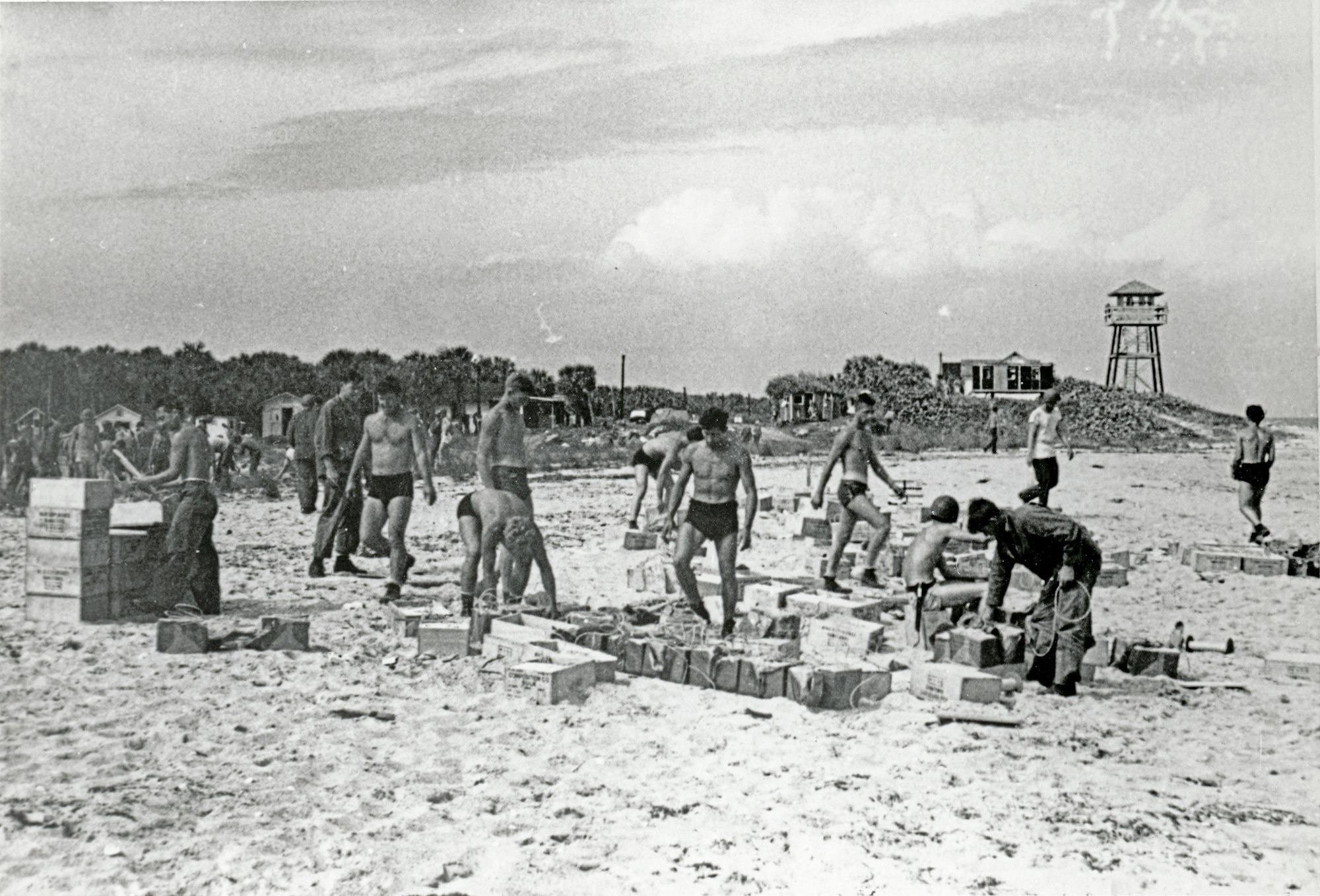
Military service men moving supplies on the beach in 1946 with the spotting tower in the background.

While there were temporary openings after WWII, none remained open long. This March 7, 1945 aerials shows the Sebastian Inlet closed.
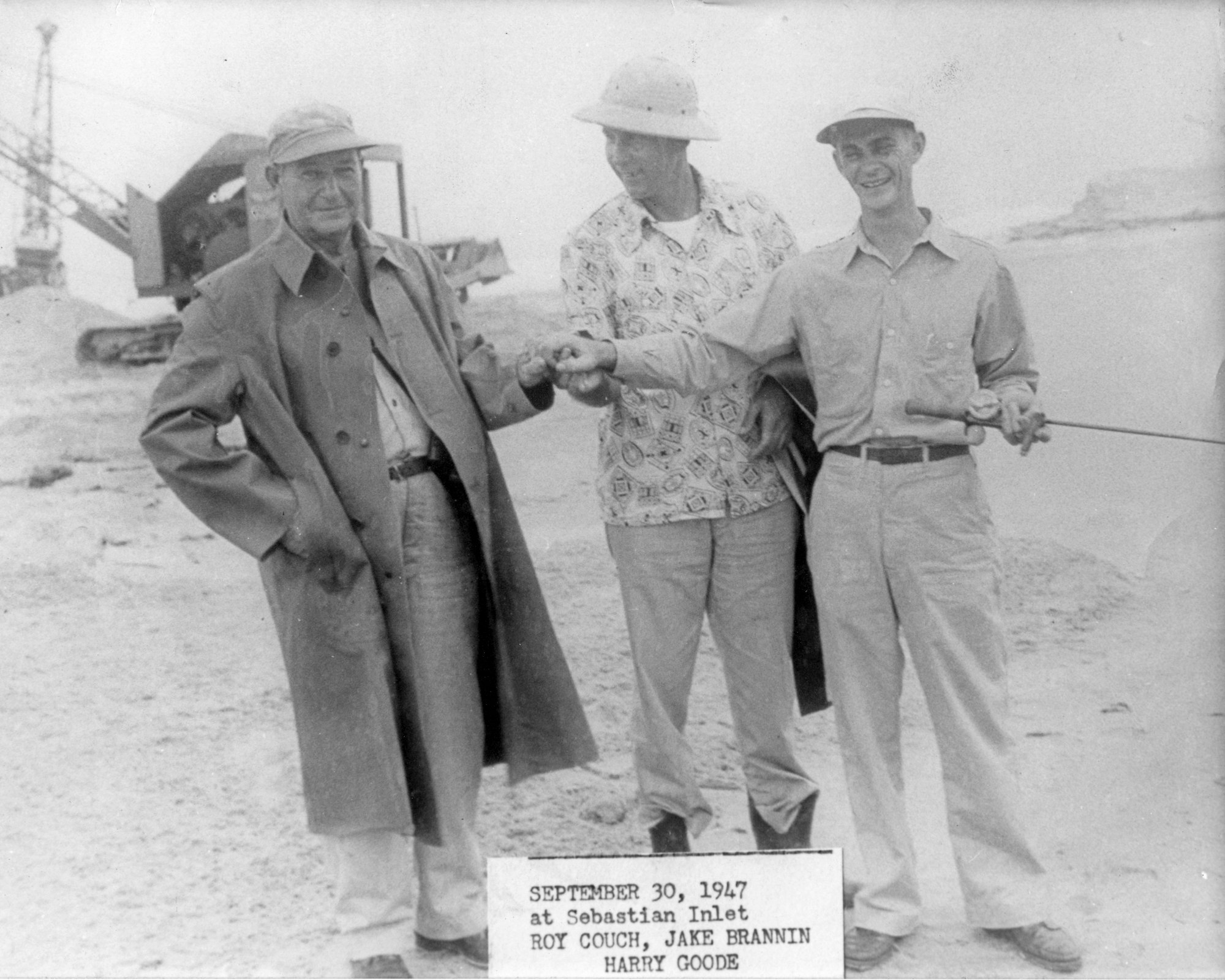
Work to open the inlet began in earnest once again in 1947. Shown here, three men that were instrumental in re-opening the Sebastian Inlet - (L to R) Roy O. Couch, Jake Brannin and Harry Goode, Sr.

Photos from construction work at the inlet in 1947. Note the WWII spotting tower in the background.

Photo from construction work at the inlet in 1947.
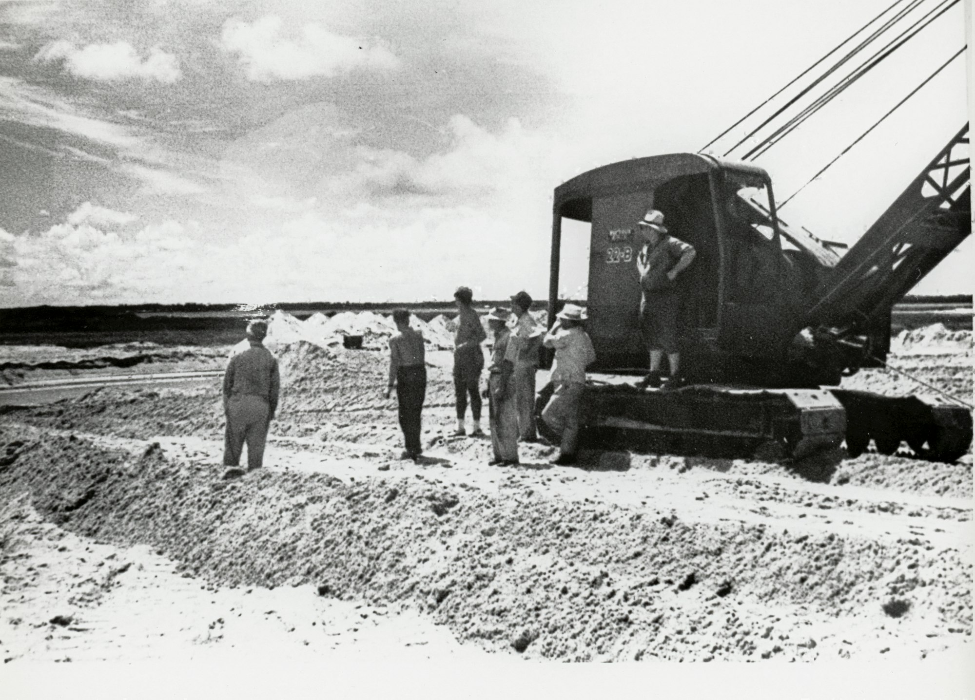
An excavator on the construction site at the inlet in 1947.
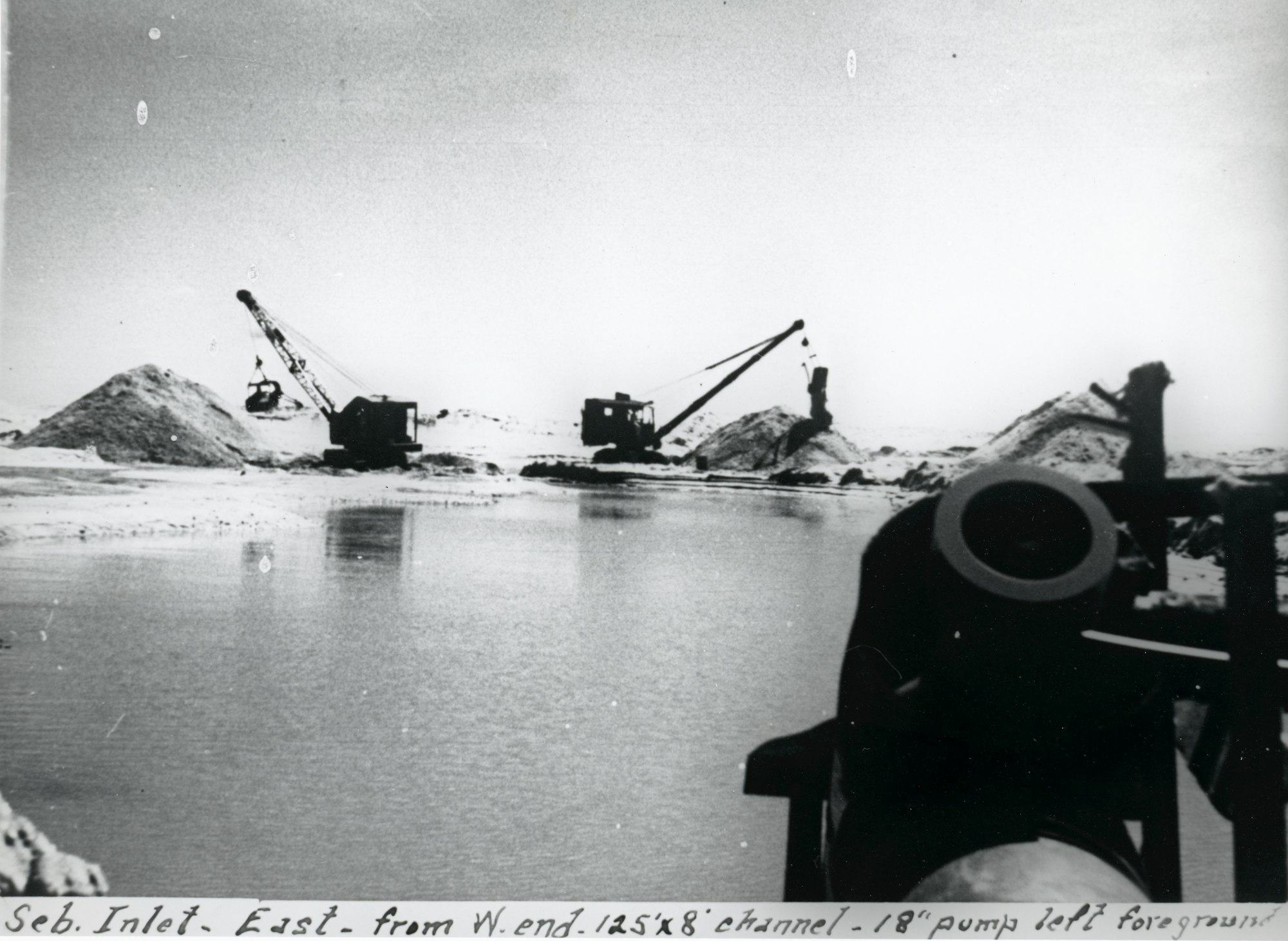
Two excavators moving sand with an 18-inch pump in foreground from 1947.
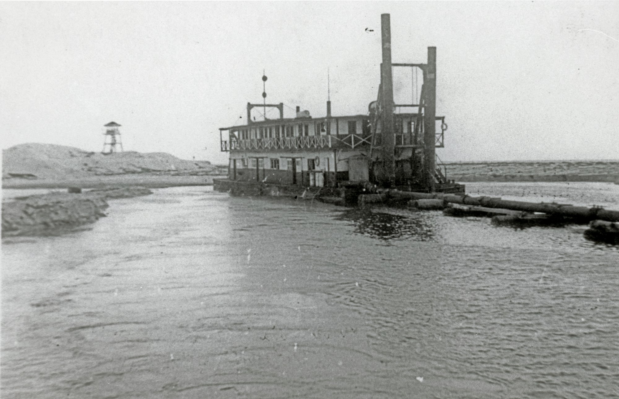
Work would continue into 1948. Shown here, the dredge "Summer Dade".
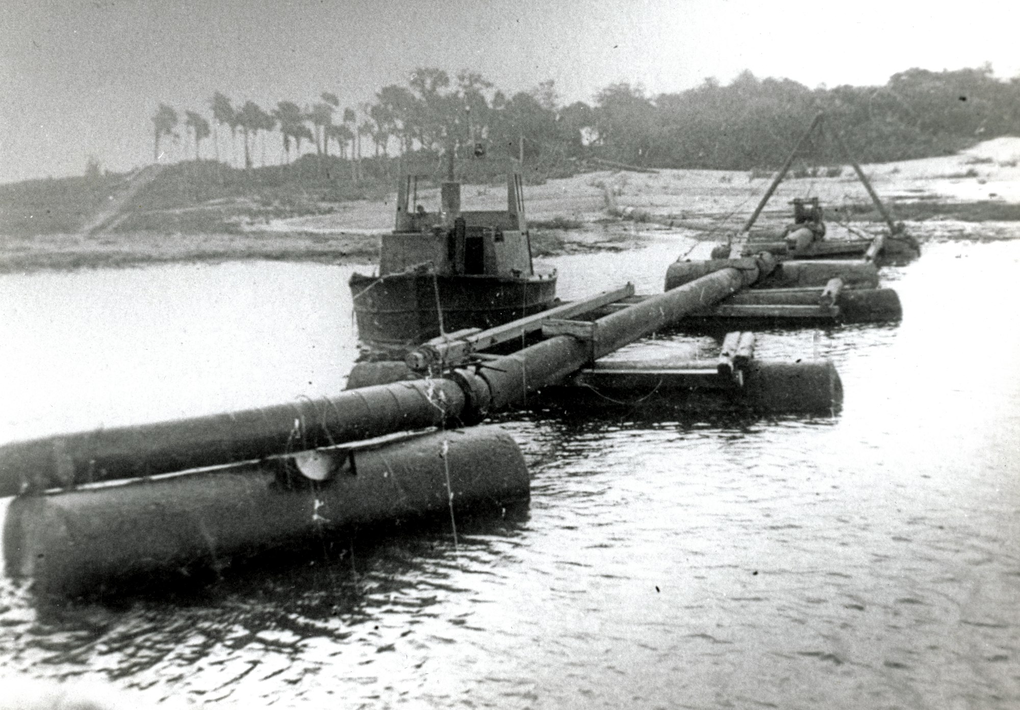
Floating dredge pipe from 1948.
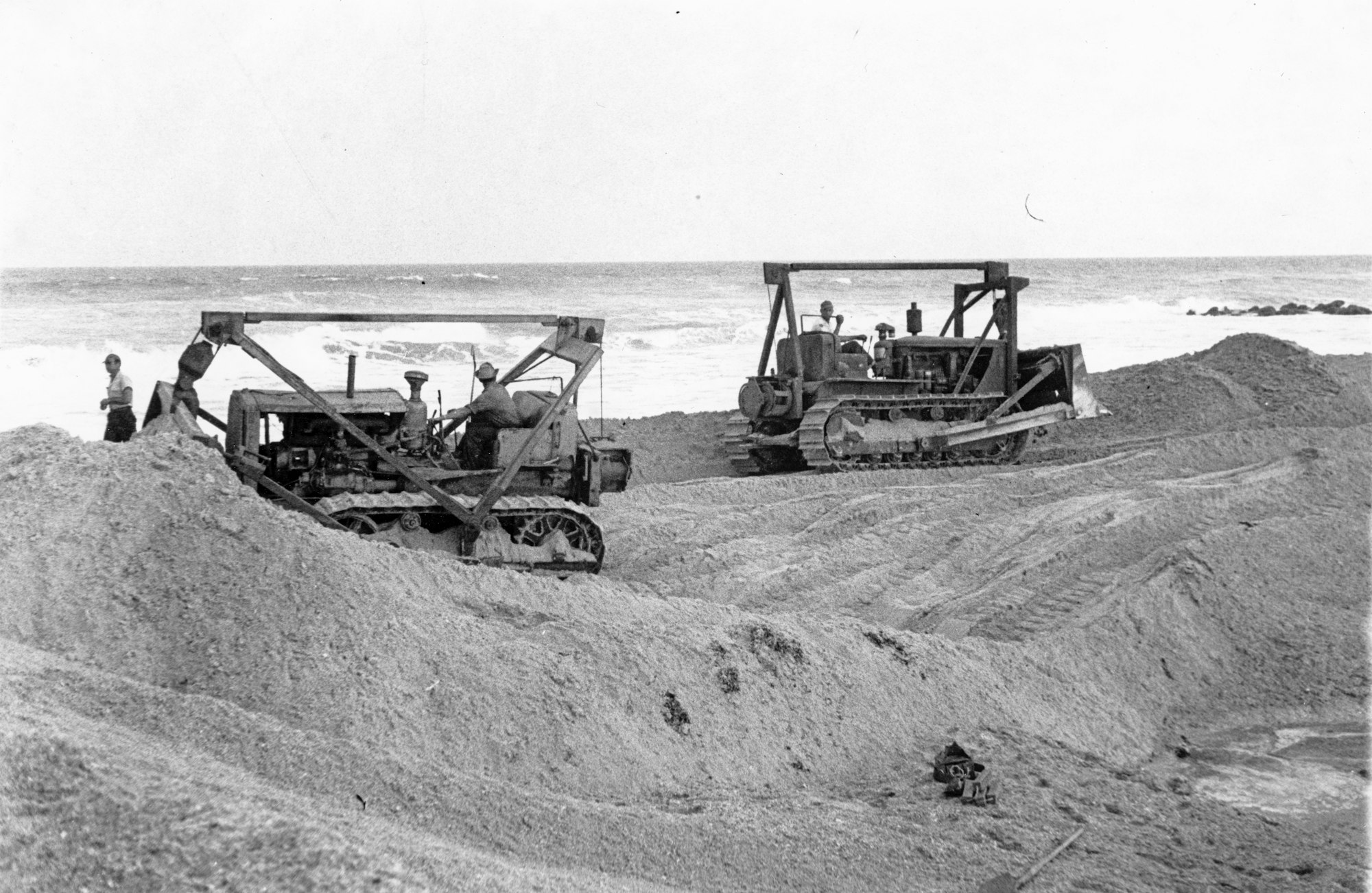
Two bulldozers moving sand in 1948.
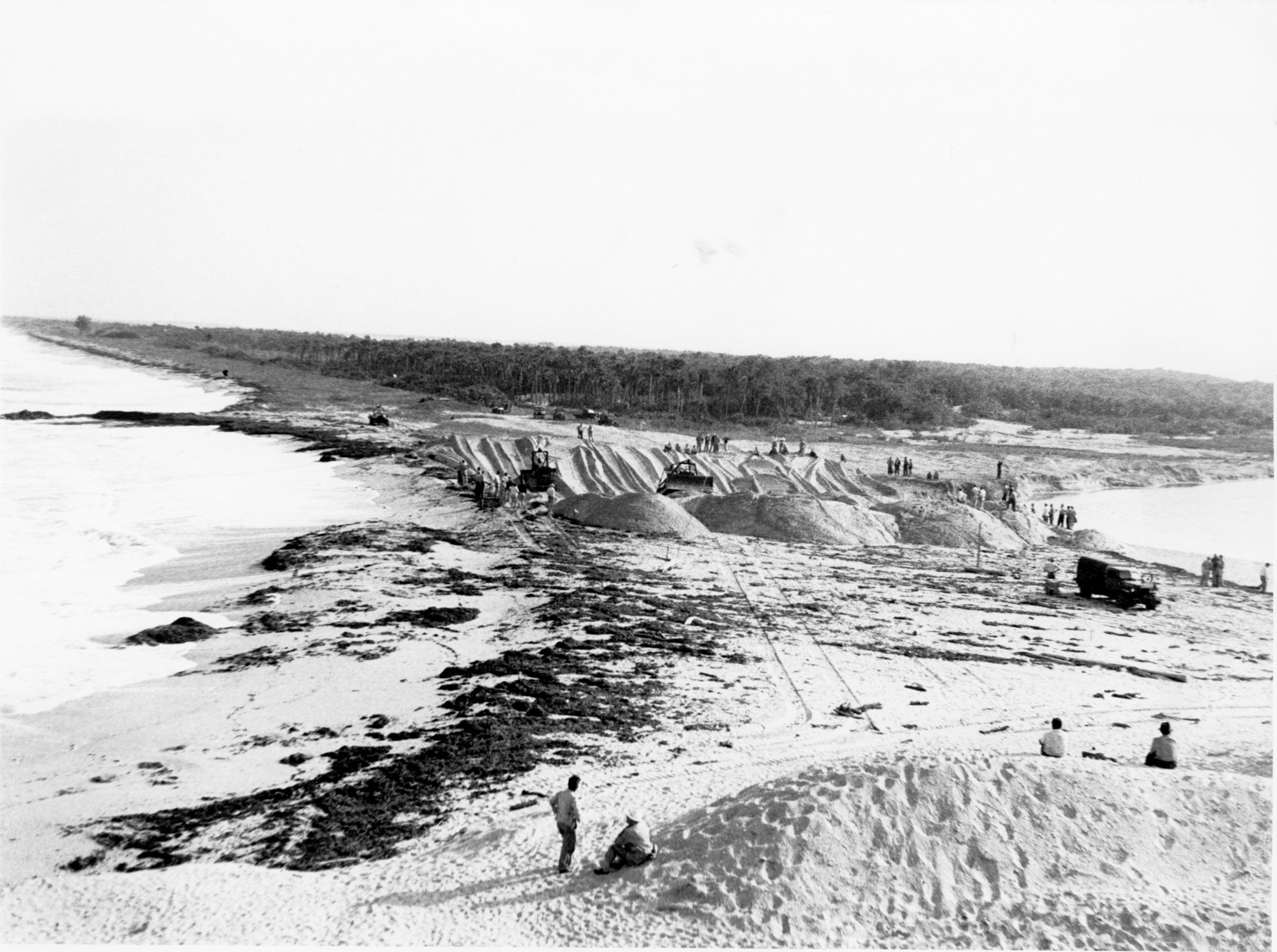
Shown here, construction work on the final plug of sand between the Indian River and the waters of the Atlantic Ocean in October 1948.
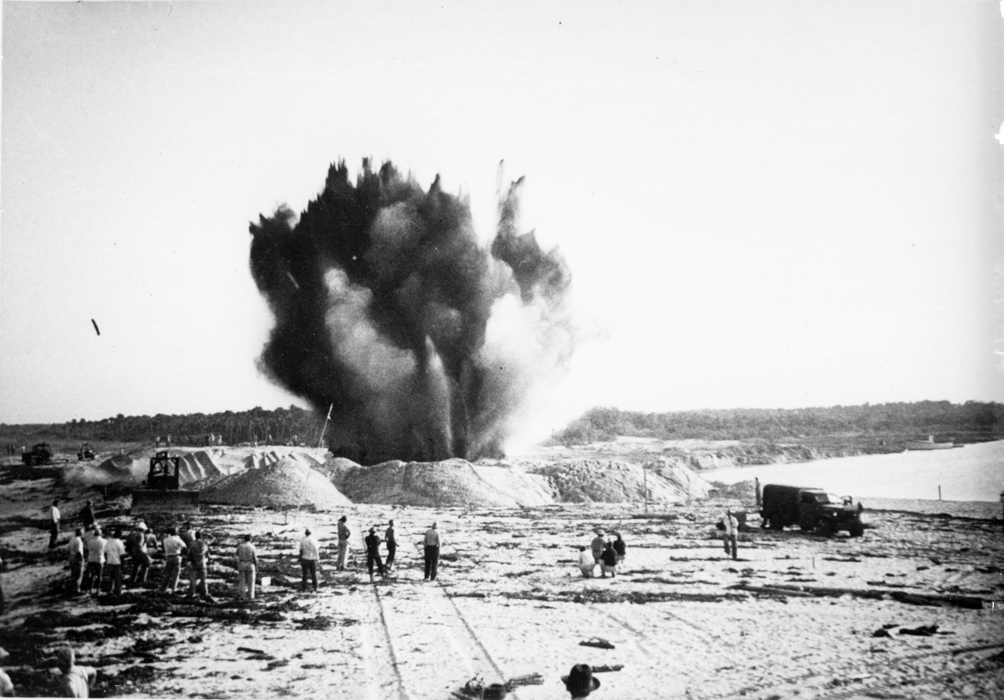
In 1948, using surplus U.S. Navy demolitions left behind, Roy O. Couch, Harry C. Goode, Sr., Jake Brannin and others pictured here blasted the Inlet open again. It has remained open ever since.

First water flows through the newly opened cut.
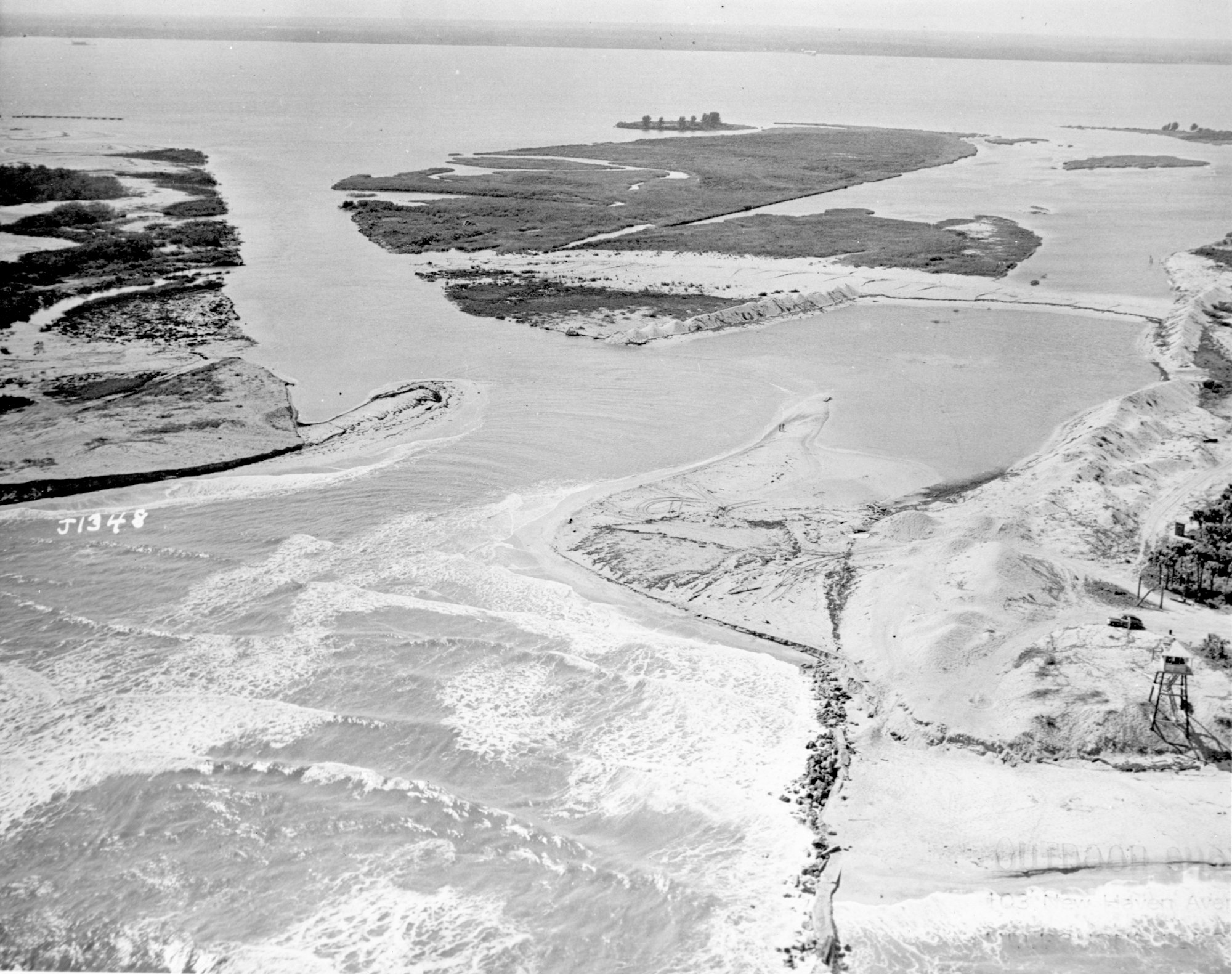
An aerial view of the inlet from 1948 once fully completed.
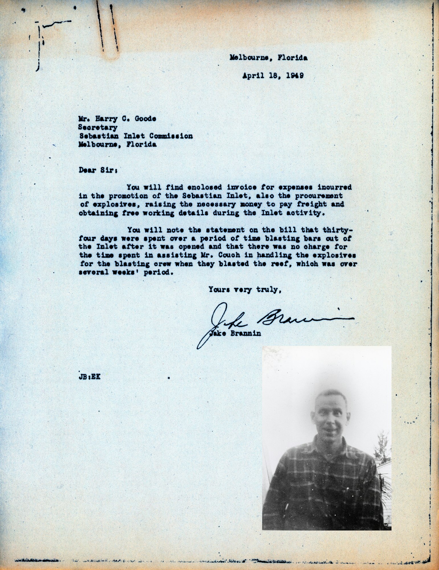
This April 19, 1949 letter accompanied by a typed expense report submitted for payment by Jake Brannin for the construction work and blasting done in 1948. It makes for one of the most interesting stories associated with the opening of Sebastian Inlet.
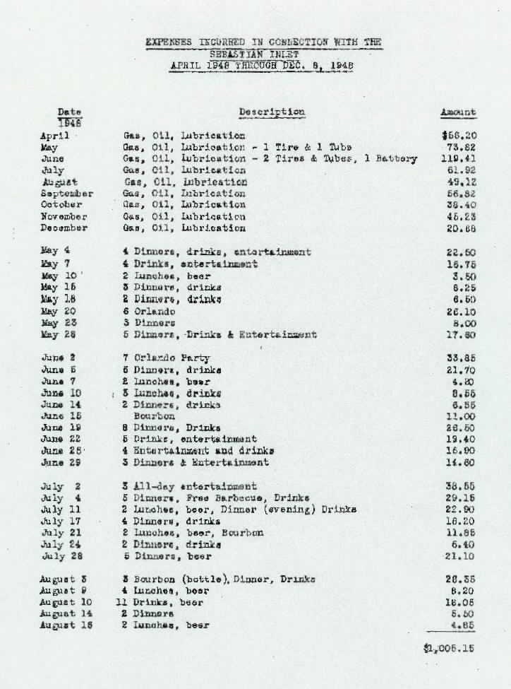
Page 1 of the typed expense report submitted with Jake Brannin's letter.
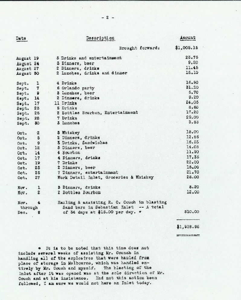
Page 2 of the typed expense report. Note all of the entries for drinks, beer, whiskey and bourbon, followed by confirmation that these men were also hauling dynamite.
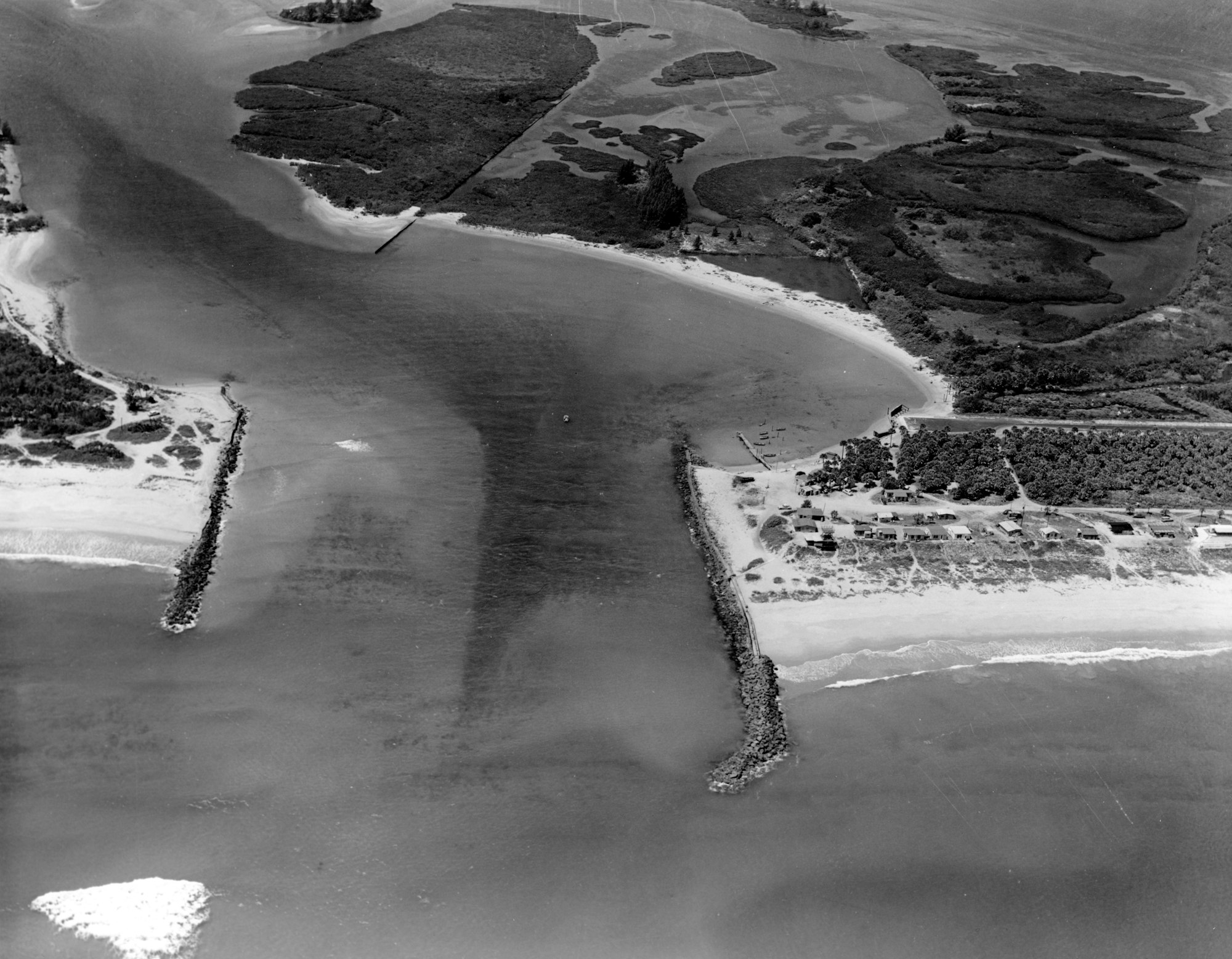
Throughout the 1950s, a number of projects were completed at the inlet. A total of four maintenance dredging projects were completed to deepen and widen the inlet channel removing a total of 355,600 cubic yards of sediment.

Also in the 1950s, new concrete construction extended both the north and south jetties, 250 and 175 feet respectively.
.jpg?ixlib=rb-1.1.0&w=2000&h=2000&fit=max&or=0&s=ad88d3be1d4197c8339b2a442d0cb67a)
Harry Goode, Sr.'s sons walking on the completed south jetty.

A 1952 photo of the Goode family. Katherine Goode with Richard, Harry Jr. and Kathy.

1952 scene at Sebastian Inlet.
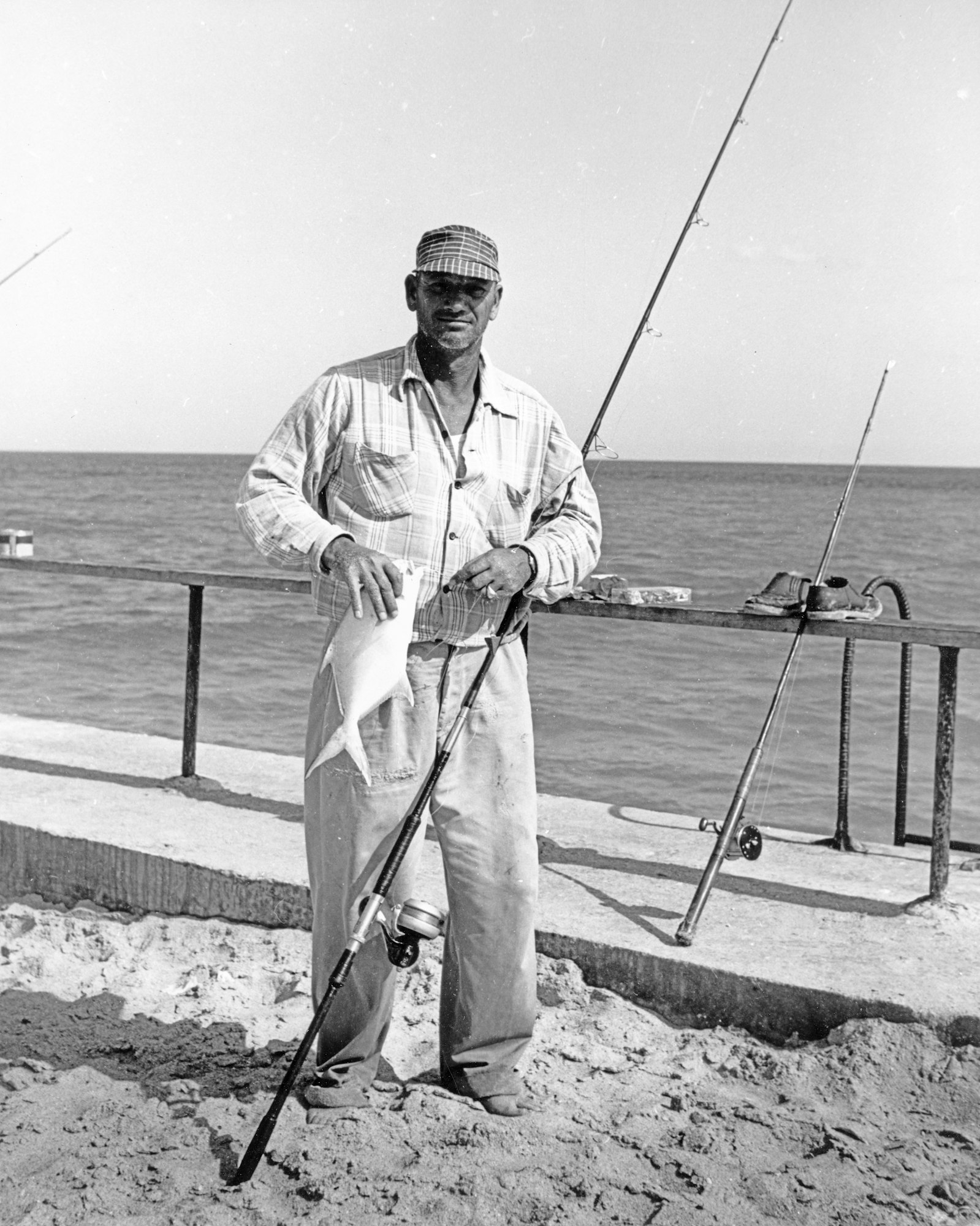
Howard "Hot Rod" Perry showing off his catch from the jetty.

Howard "Hot Rod" Perry with his family at Sebastian Inlet.
In 1962, a channel dredging project was completed and the Inlet’s Sand Trap was excavated to capture sand that would otherwise cause shoaling.

This project removed 281,147 cubic yards of sand and rock at a cost of $247,138, according to Sebastian Inlet District archives.
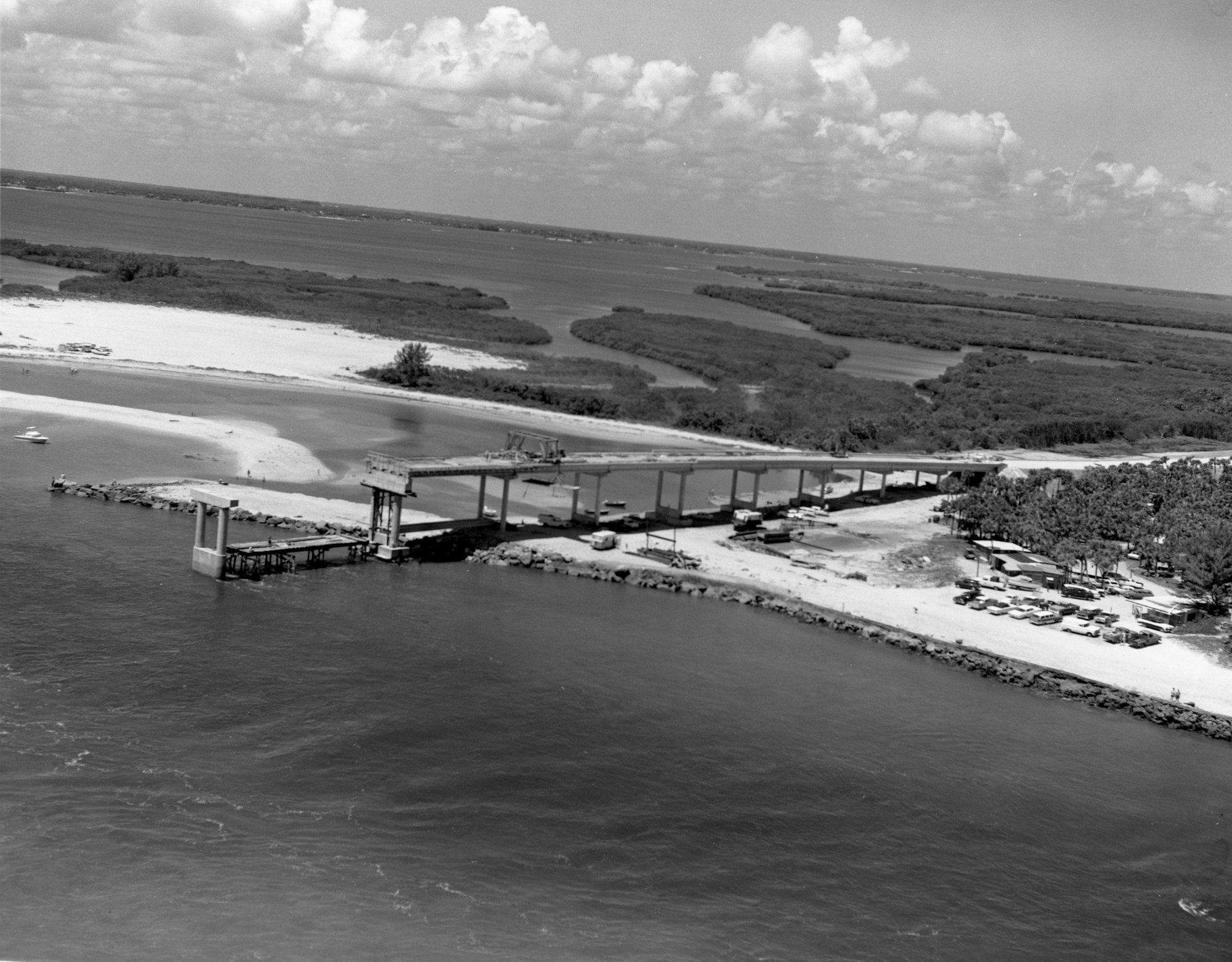
An event of major significance would get underway in 1964, construction of the bridge over the Sebastian Inlet.

On February 27, 1965, the bridge that crosses over the Sebastian Inlet was opened connecting A1A. In return for helping complete the bridge and pave A1A on the south side, Brevard County cedes almost 3 miles of land South of the Inlet to Indian River County.

More than 6,000 people attended the ceremony where Senator Merrill P. Barber served as master of ceremonies, and guests included state officials, commissioners of Indian River and Brevard counties and the Sebastian Inlet District.
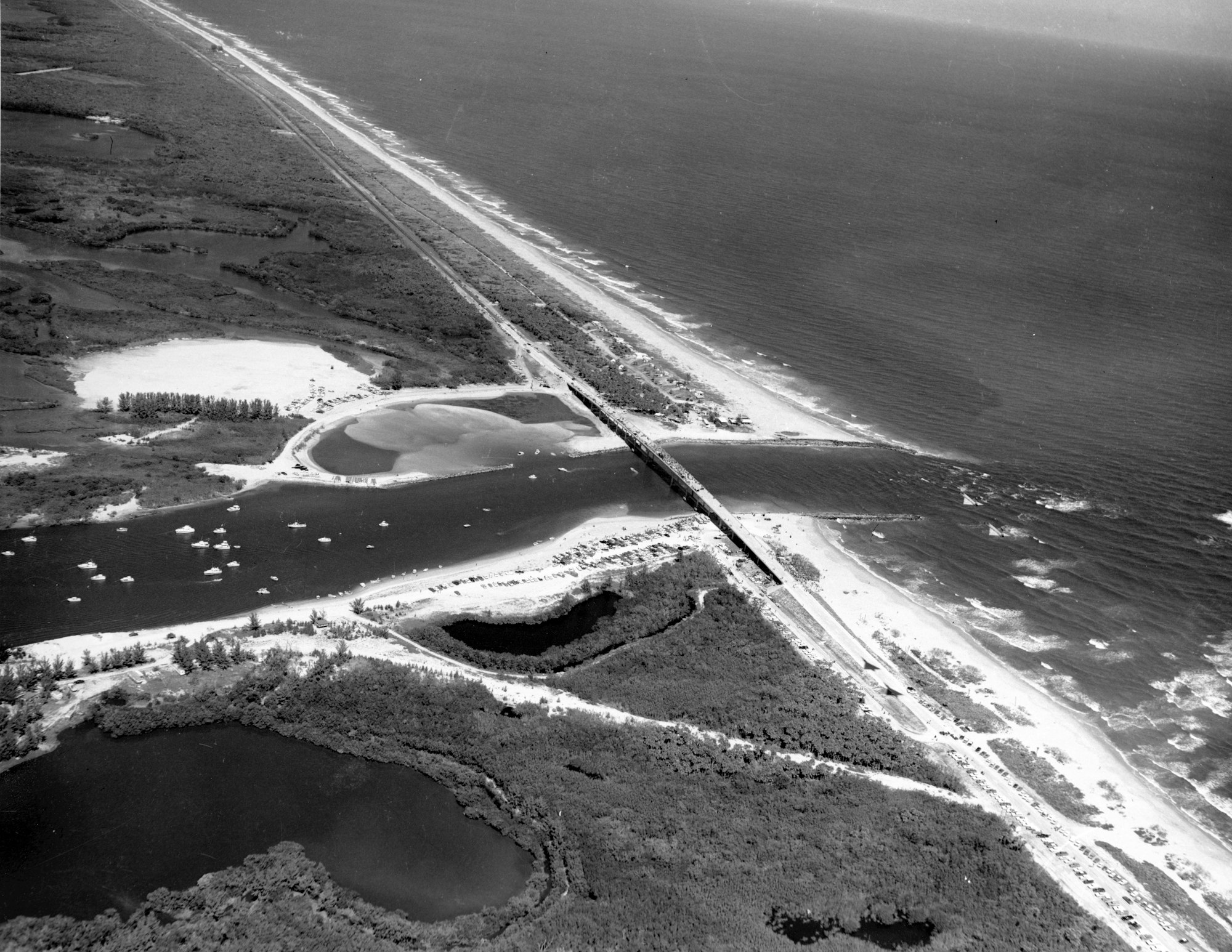
Look closely at the lower right hand corner of this photo and the next, and you’ll see shadows of two jet fighters roaring over the crowd from the Florida National Guard in Jacksonville.

The next two images are high-altitude aerials showing the newly completed bridge over the inlet and Indian River Lagoon.
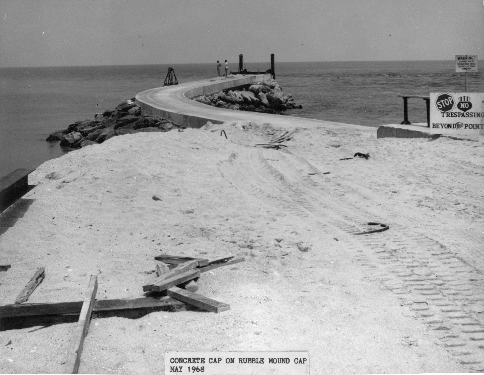
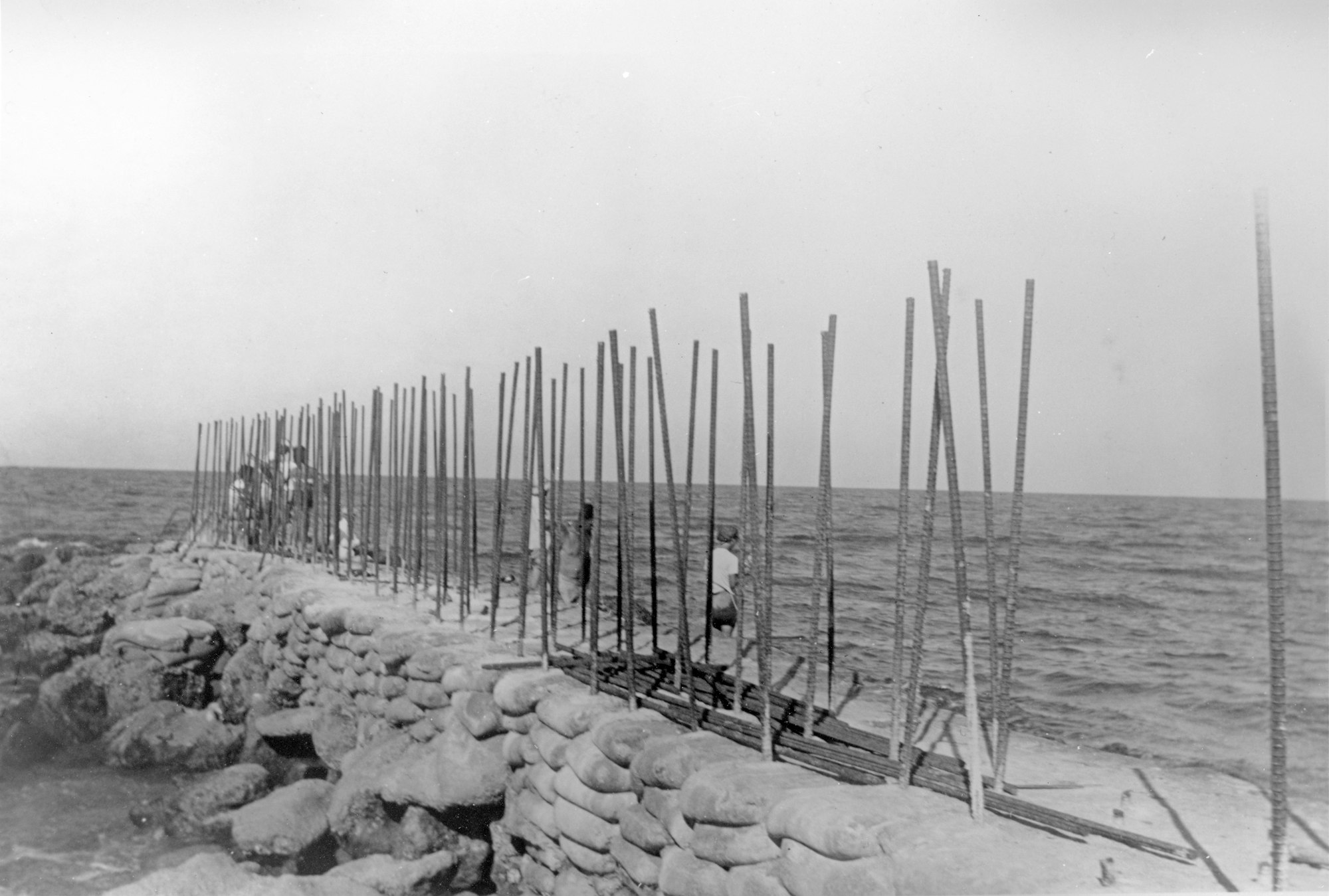
In 1968, work begins on another major project-a complete overhaul and 500-foot extension of the North Jetty to incorporate the crib structure seen present day. Work would extend into early 1970.
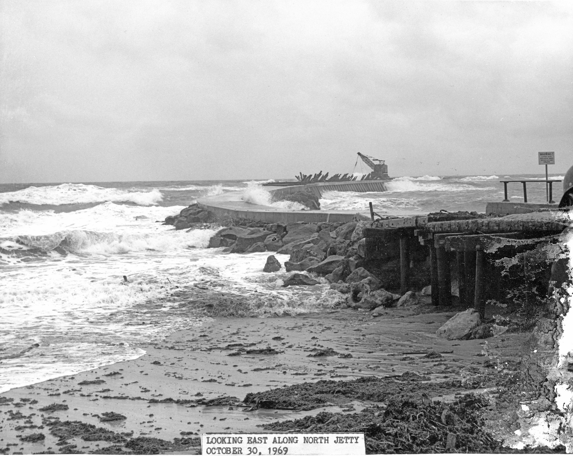
In October of 1969, a storm causes damage to the almost complete north jetty.
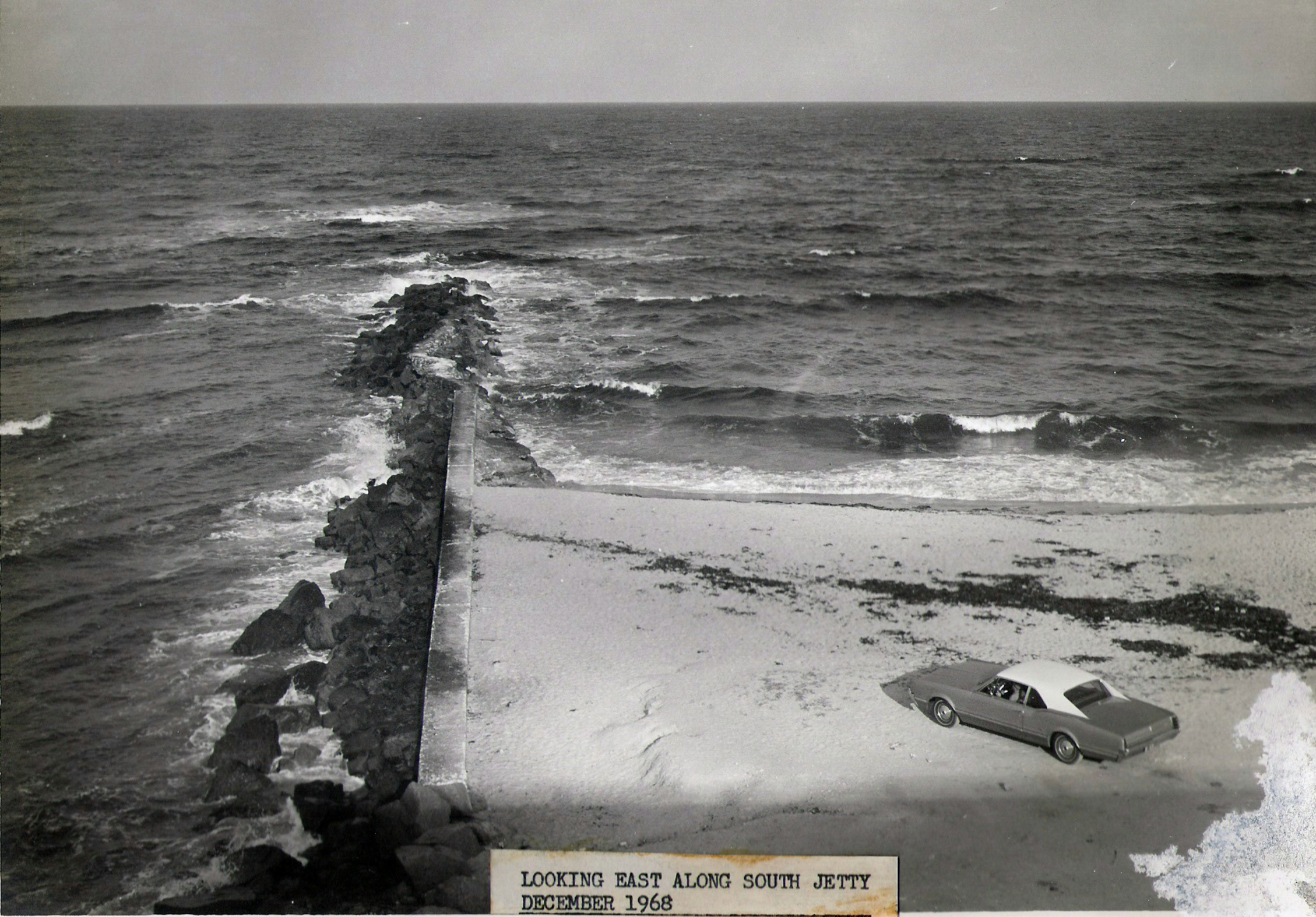
After completing work on the North Jetty, a project to extend and add a concrete cap to the South Jetty begins. Shown here, a photo of the South Jetty from December 1968 before work begins.
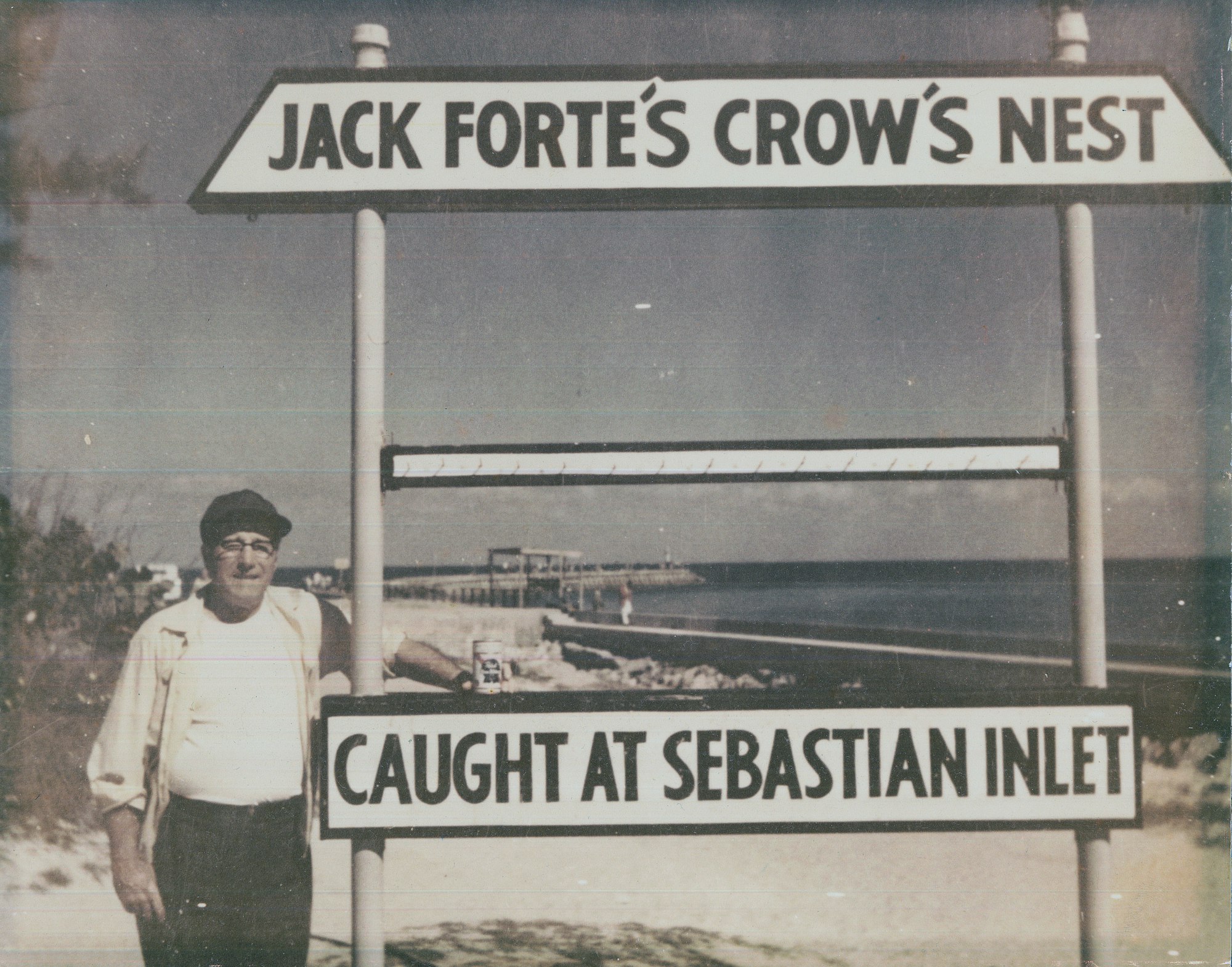
Jack Forte’s Crow’s Nest, a well-known fish camp located by the North Jetty, was an institution at Sebastian Inlet for many years. Forte would become an outspoken advocate for local fisherman in a clash that erupted as an unintended consequence of the North Jetty extension.
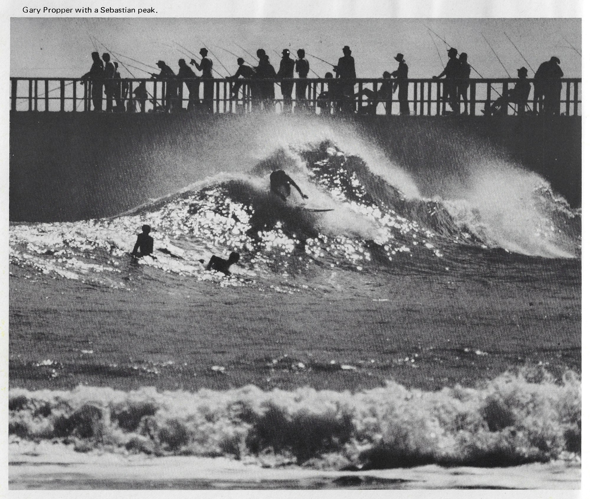
The jetty extension created what some argue was one of the best waves on the East Coast, dubbed “First Peak” by the surfing community. It would produce world-class champion surfers in the 70s, 80s, and 90s.

For months, fisherman and surfers clashed until signing a peace pact in April 1970, and in reality, the feud between the two groups continued.
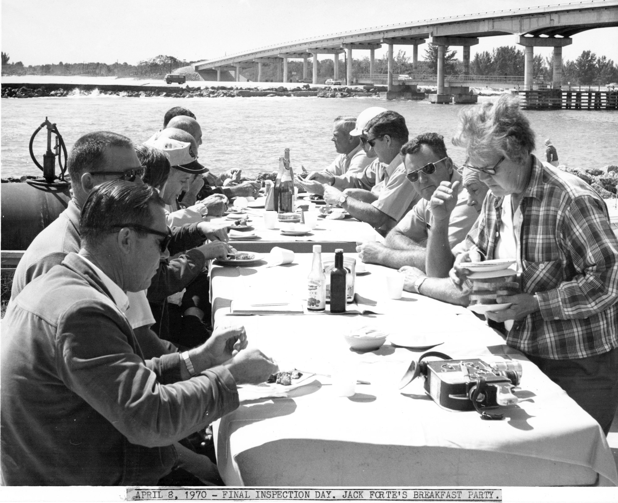
Just four days after signing the peace pact with the surfers, Jack Forte would host a breakfast party on April 9, 1970 for the final inspection of the new North Jetty. Among those pictured here, Harry C. Goode, Sr. who blasted the inlet open back in 1948.

On April 19, 1970, a navigation light is installed at the tip of the North Jetty.
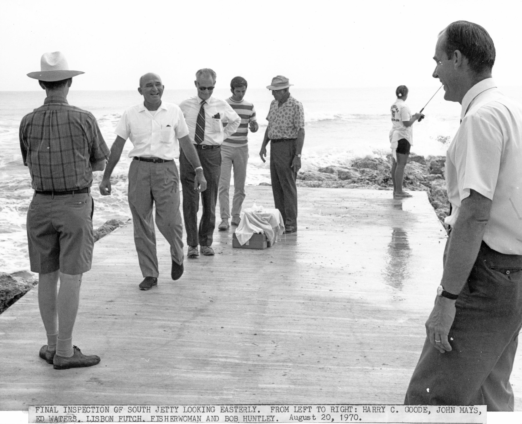
The following day, the final inspection of the improvements to the South Jetty takes place with Sebastian Sebastian Inlet District Commissioners Harry C. Goode, Sr., John Mays and Lisbon Futch in attendance.
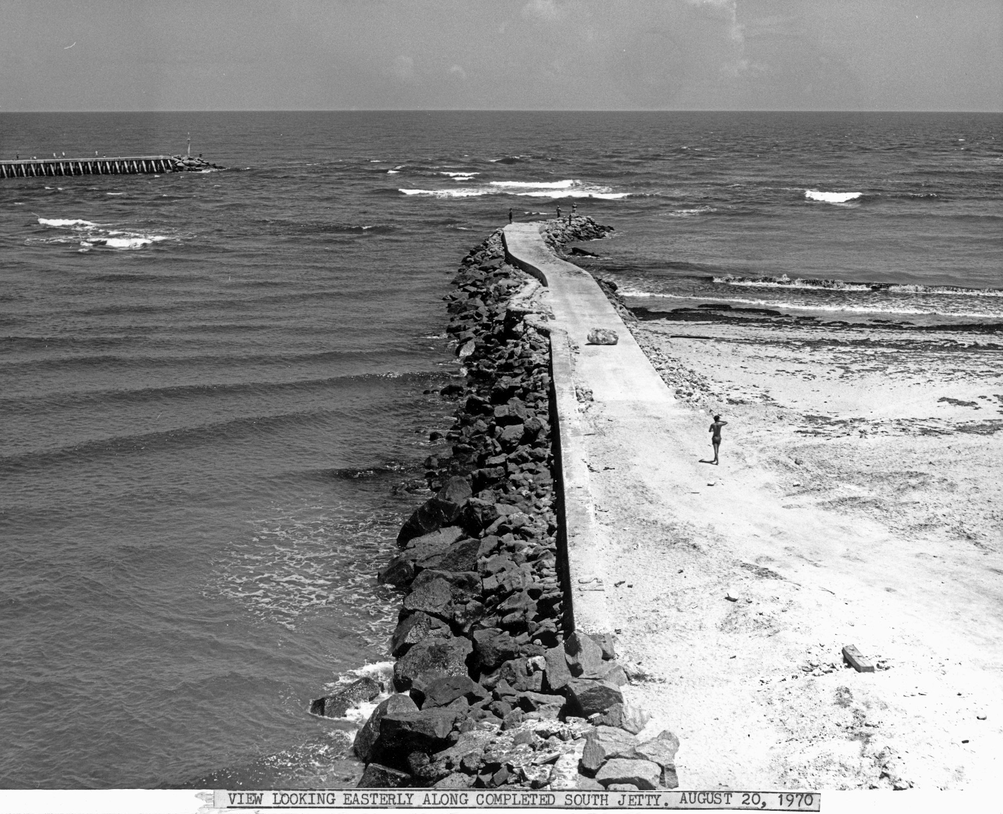
Shown here, the completed South Jetty from 1970.
.jpg?ixlib=rb-1.1.0&w=2000&h=2000&fit=max&or=0&s=41a9769299c8c96945f091cd6ca841d1)
Another event of major significance - the Sebastian Inlet State Park is established in 1971 after the State of Florida acquires the land surrounding the inlet the prior year. It consistently ranks as one of the most visited parks in the entire state.
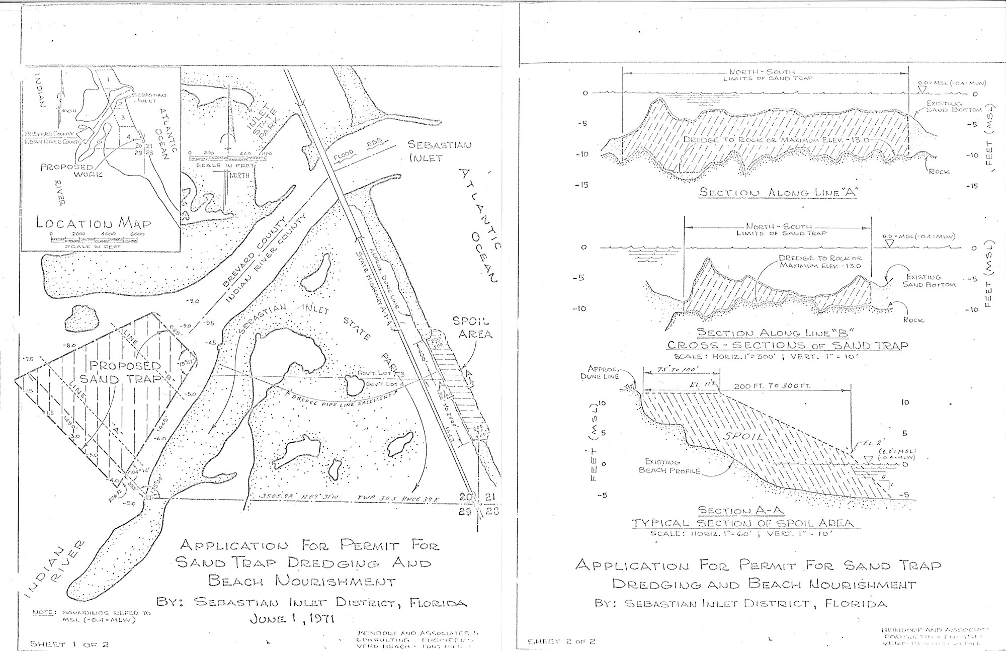
In 1972, the Sand Trap is deepened and the accumulated sand is dredged. 420,000 cubic yards of sand was placed on the downdrift beach to counter erosion. Shown here, specs submitted during the permitting process in 1971.
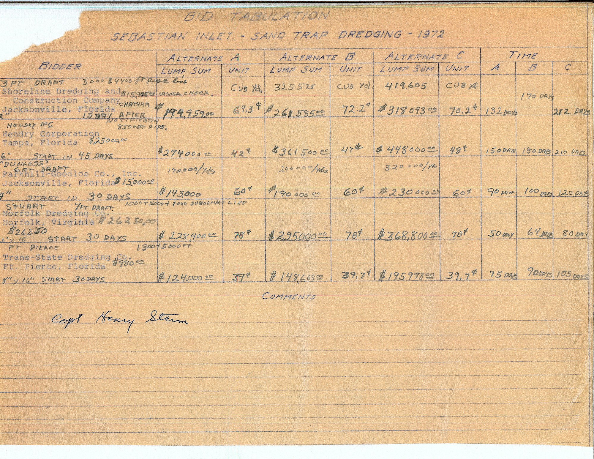
The new Sand Trap is 32 acres and the entire project was completed for a cost of $195,998. Shown here, the Bid Tabulation Sheet.
In 1978, 286,500 cubic yards of sand are excavated from the sand trap and 187,600 cubic yards of sand are placed on downdrift beaches with the remaining rock deposited in the south point spoil area, known today as Coconut Point.
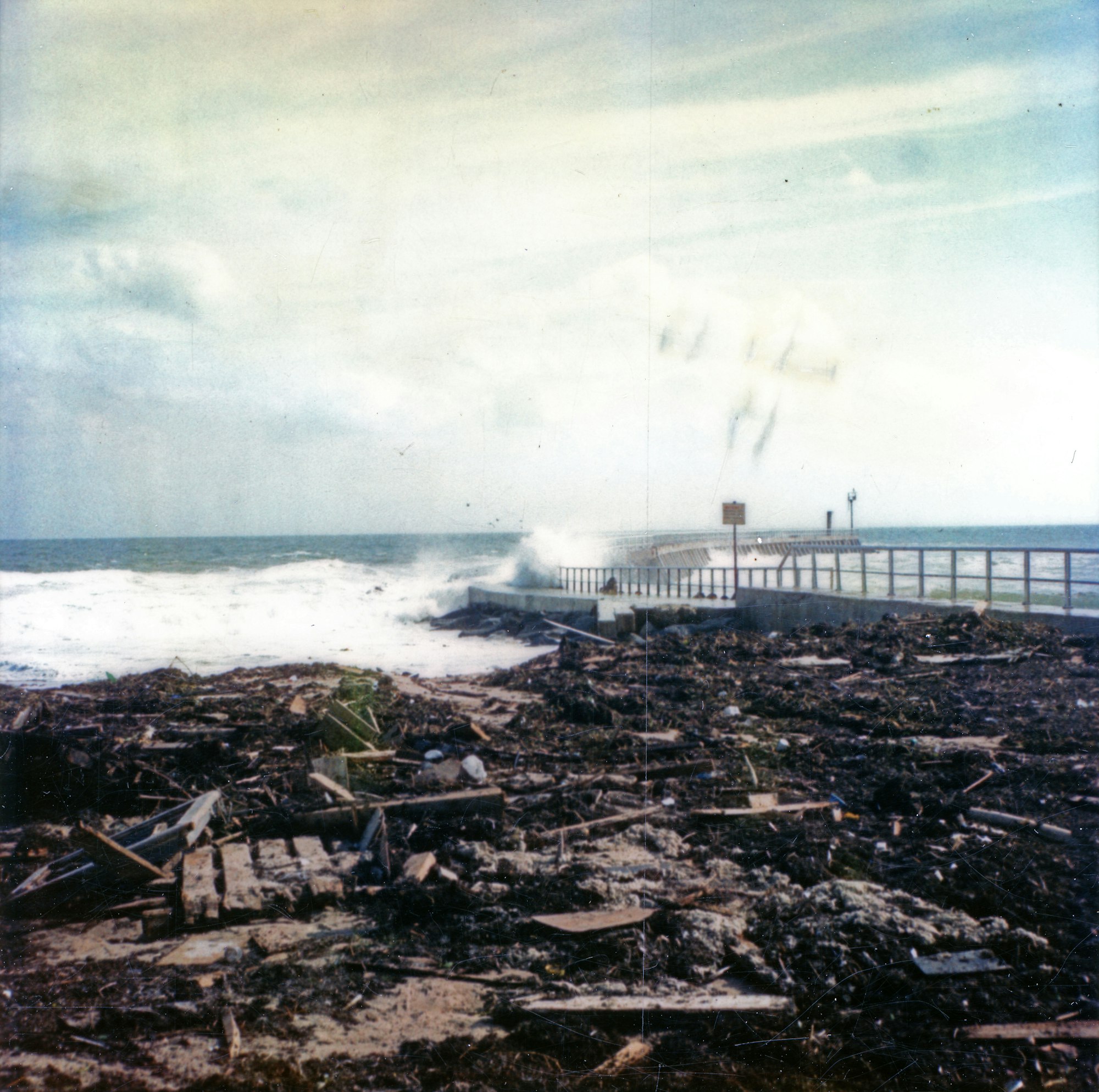
In November 1981, an unnamed subtropical storm wreaks havoc on Sebastian Inlet causing major damage shown here and produced coastal flooding and beach erosion along the Eastern coastline while located over the open Atlantic Ocean. Repair work would continue for years.
.jpg?ixlib=rb-1.1.0&w=2000&h=2000&fit=max&or=0&s=3ada8b6f897ed4b25834b7cefcbce51e)
In the late 1980s, an almost entirely new Commission would institute a series of reforms, hiring the District’s first professional administrator, Raymond LaRoux, and earning State-wide recognition for creating the first inlet management plan.

Throughout the 1990s, the District partners with higher education to conduct what would become the first of many scientific studies taking place at the inlet. One of the first studies looked at the effects of beach renourishment on sea turtle hatchling success.
Shown here, the first of four dredging and beach placement projects completed in the 1990s, placing 800,000 cubic yards of sand on downdrift beaches.
In 1993, Florida Tech installed the wave gauge at the Sebastian Inlet.

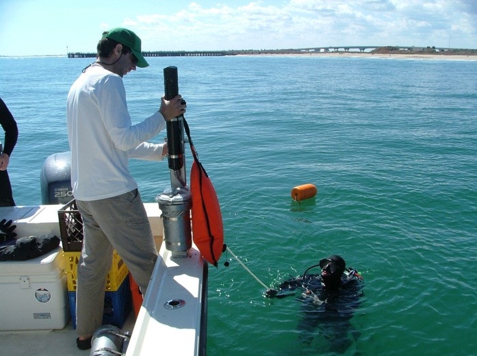
Shown here, the location of an acoustic doppler current profiler with 4 sensor heads. It measures water pressure, elevation and velocity to determine speed and direction. Also shown, the location of the meteorological station at the end of the North Jetty installed in 1997.
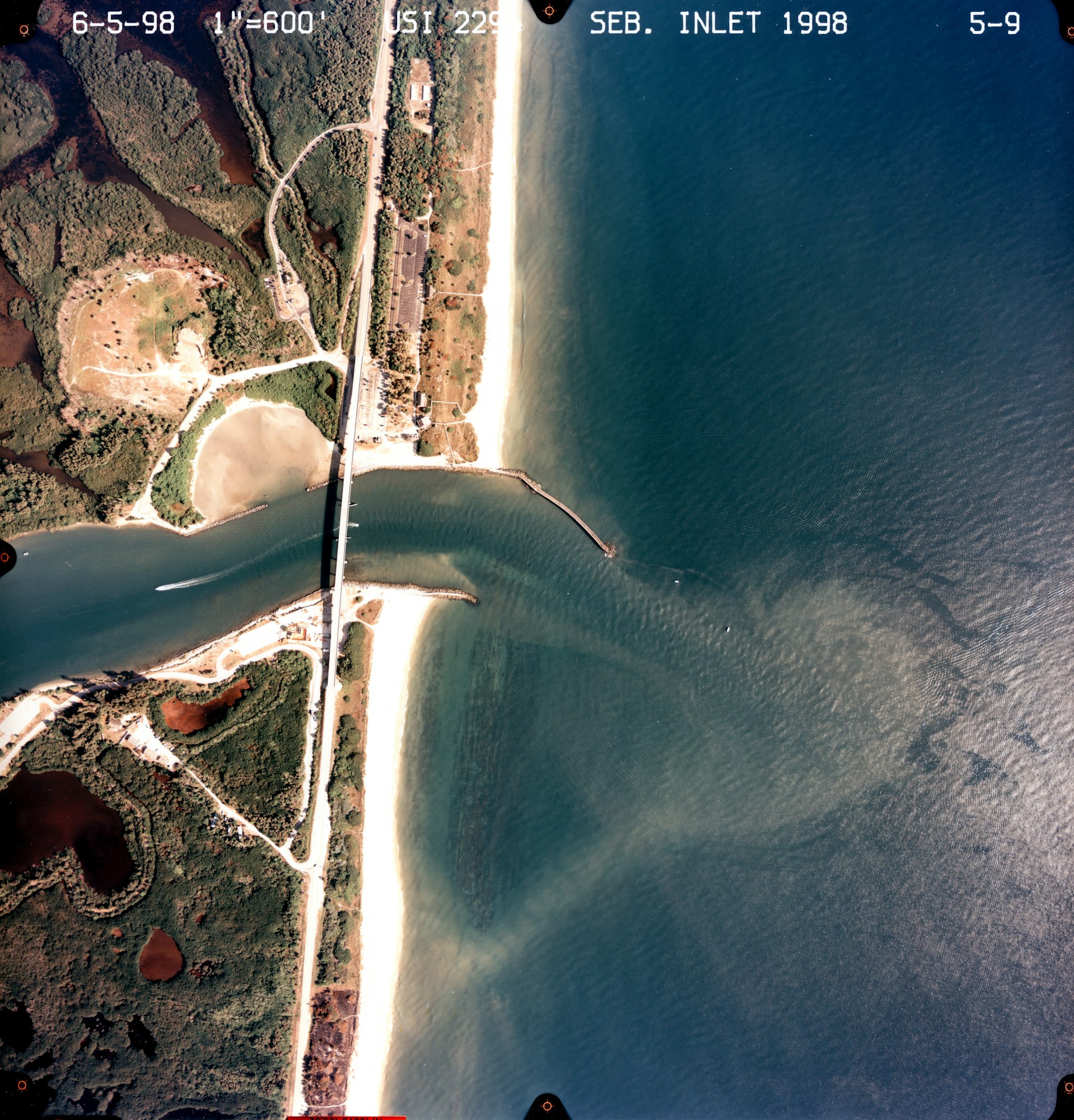
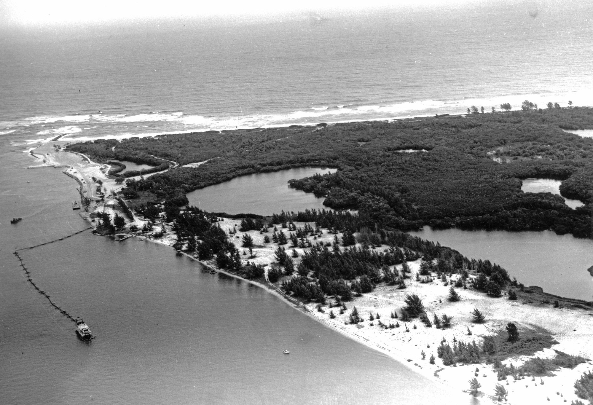
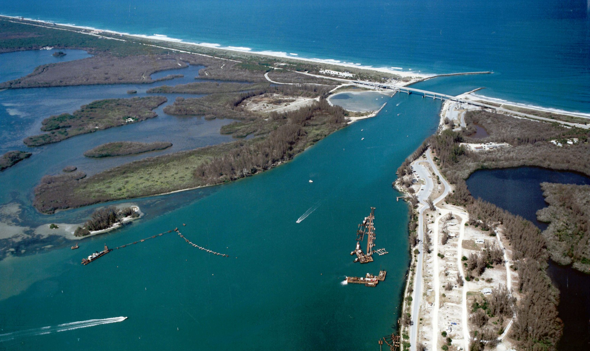
These aerial photos taken on June 5, 1998 show the development of Sebastian Inlet State Park.
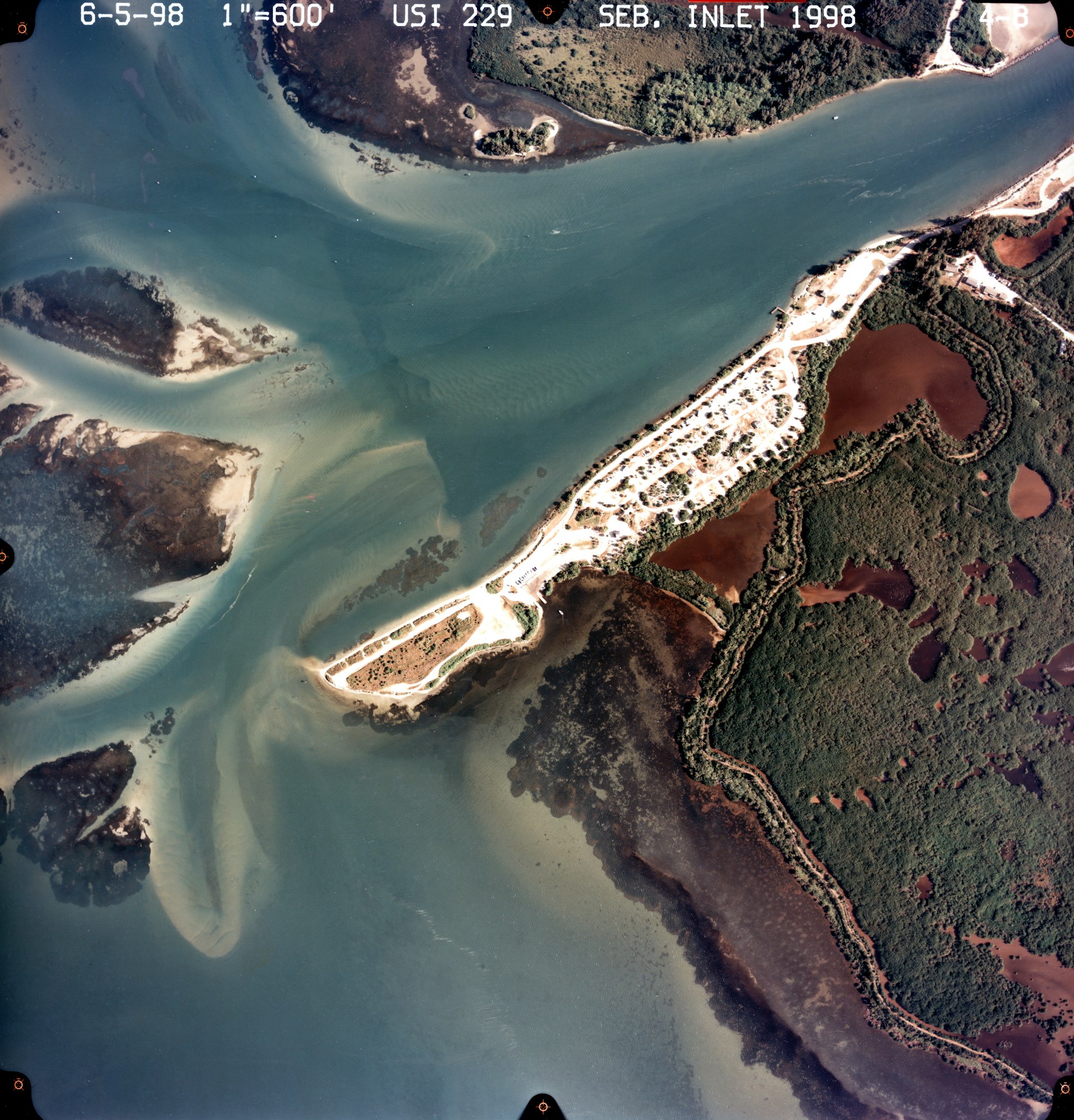
Numerous improvements were made in the 1990s; the addition of pavilions at Coconut Point and the Fishing Museum, upgrades to the boat ramps, installation of potable water systems and building the concession for park guests.

The Sebastian Inlet District begins its fourth project during this decade to place sand onto downdrift beaches per the State of Florida’s Beach Management act that mandates the District bypass sand that migrates into the inlet system.

Projects are a combination of dredging the inlet’s sand trap and trucking sand in from upland sources.

In March of 2002, a major renovation of the North Jetty was underway with elevated concrete cap, handrails and a grate system.
By November of that year, the Sebastian Inlet District completes a multi-year, five phase beach renourishment that places more than 200,000 cubic yards of sand on beaches to the South of Sebastian Inlet.
Both jetties survived the storms that devastated our area in 2004 without significant damage due in large part to the 2002 renovation.

By November 2004, Martin Smithson is hired as the District's second Administrator and 4 new Commissioners would be sworn in. Together, they would achieve many notable milestones in the next 15 years.

In 2007, permanent piling markers were placed in the Inlet’s throat section to better define the channel and manatee slow speed zones.
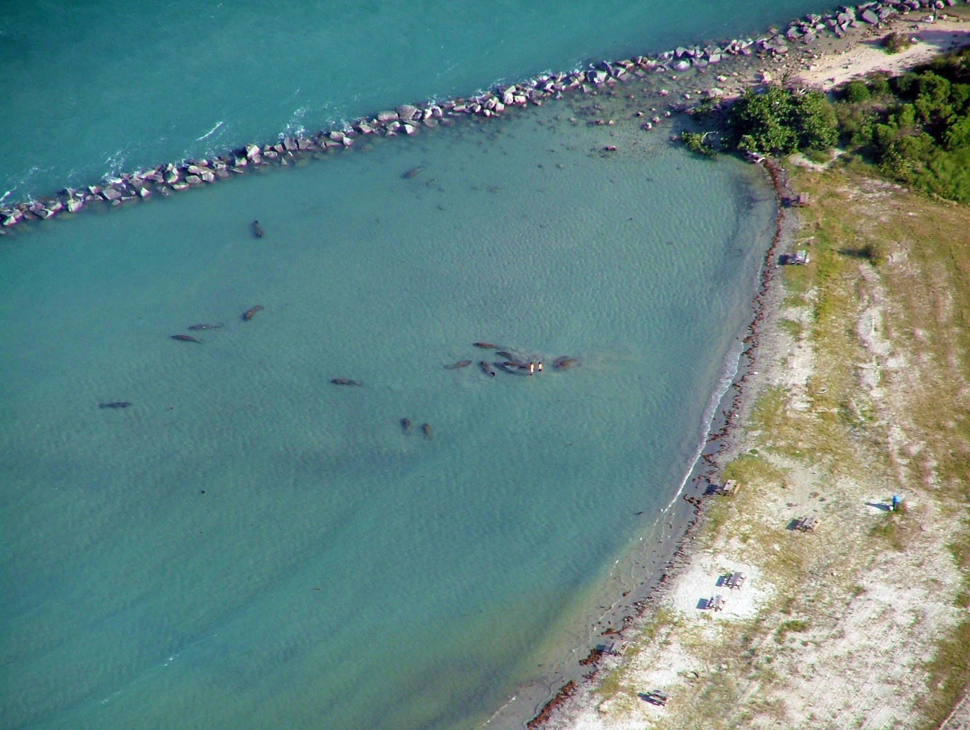
An "aggregation" of manatees in the tide pool in 2007.

Also in 2007, the popular webcam and weather station are installed on the North Jetty featuring live-feed images and video, current weather conditions, tide charts and more.

A major milestone, the District formally partners with Florida Tech to monitor seasonal sea level change, sediment or sand transport and accumulation of sand within the inlet system to manage sand resources and Dr. Zarillo publishes the first State of the Inlet Report in 2007.

After decades of unsuccessful attempts, the District receives state and federal permits to create a 3,120-foot channel connecting the inlet to the Intracoastal Waterway that is 9 ft. deep and 150 ft. wide. Work begins in 2007, and navigation markers are installed in 2008.
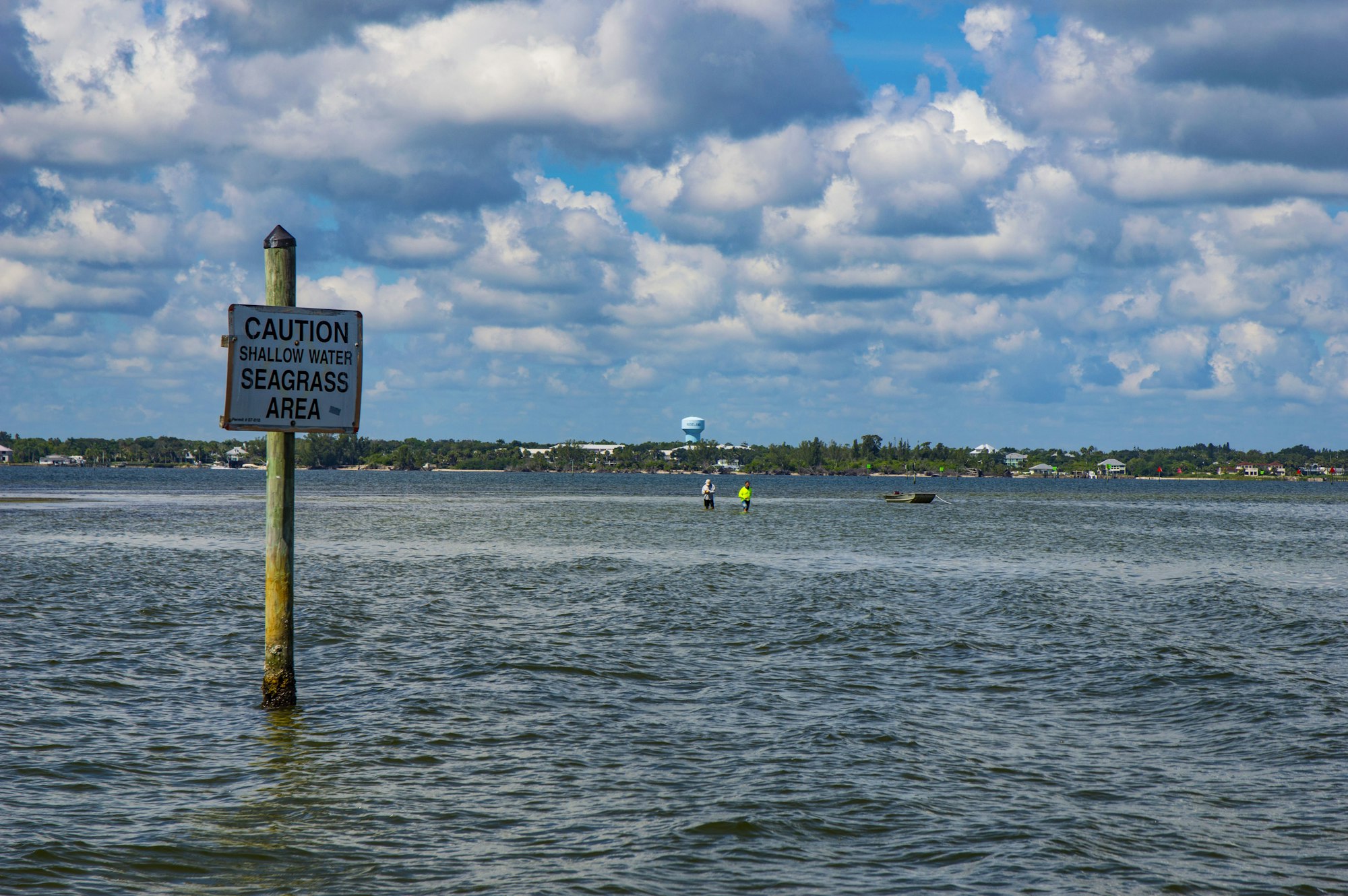
As part of this channel extension project, the District also repaired known prop scars and installed signs reading “Caution. Shallow Water. Seagrass Area.” around 145 acres of seagrass habitat in six zones on the flood shoal.

The District still works with marine biologists to monitor the seagrass beds today on an annual basis, sharing important scientific data with partners working to restore and preserve the health of the Indian River Lagoon.
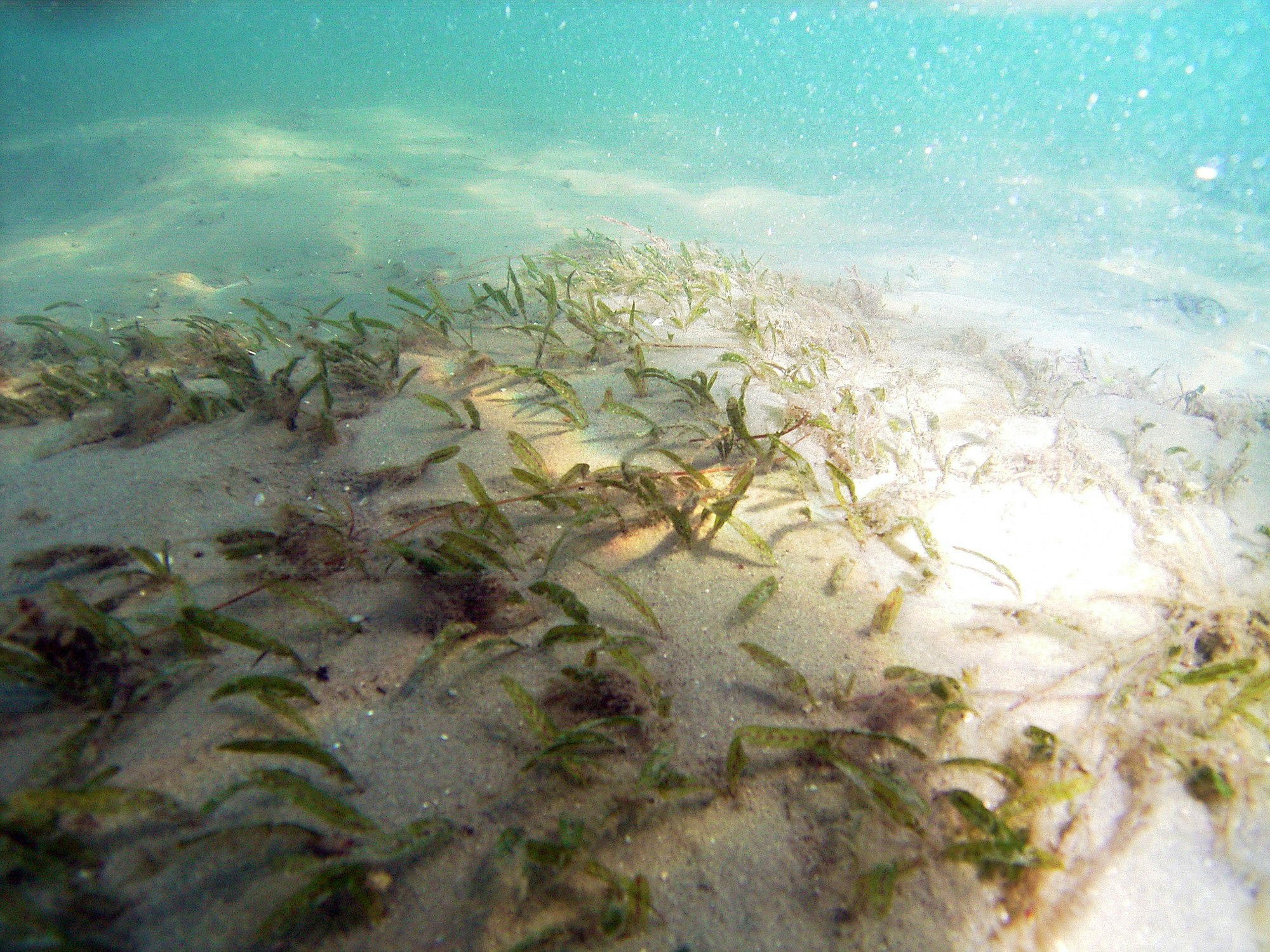
The flood shoal West of the inlet was identified as critical habitat for Johnson’s seagrass, a federally listed threatened species shown here.
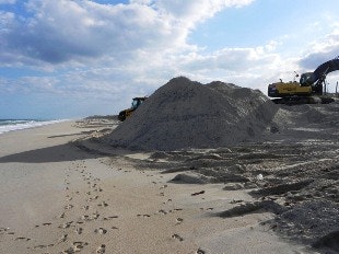
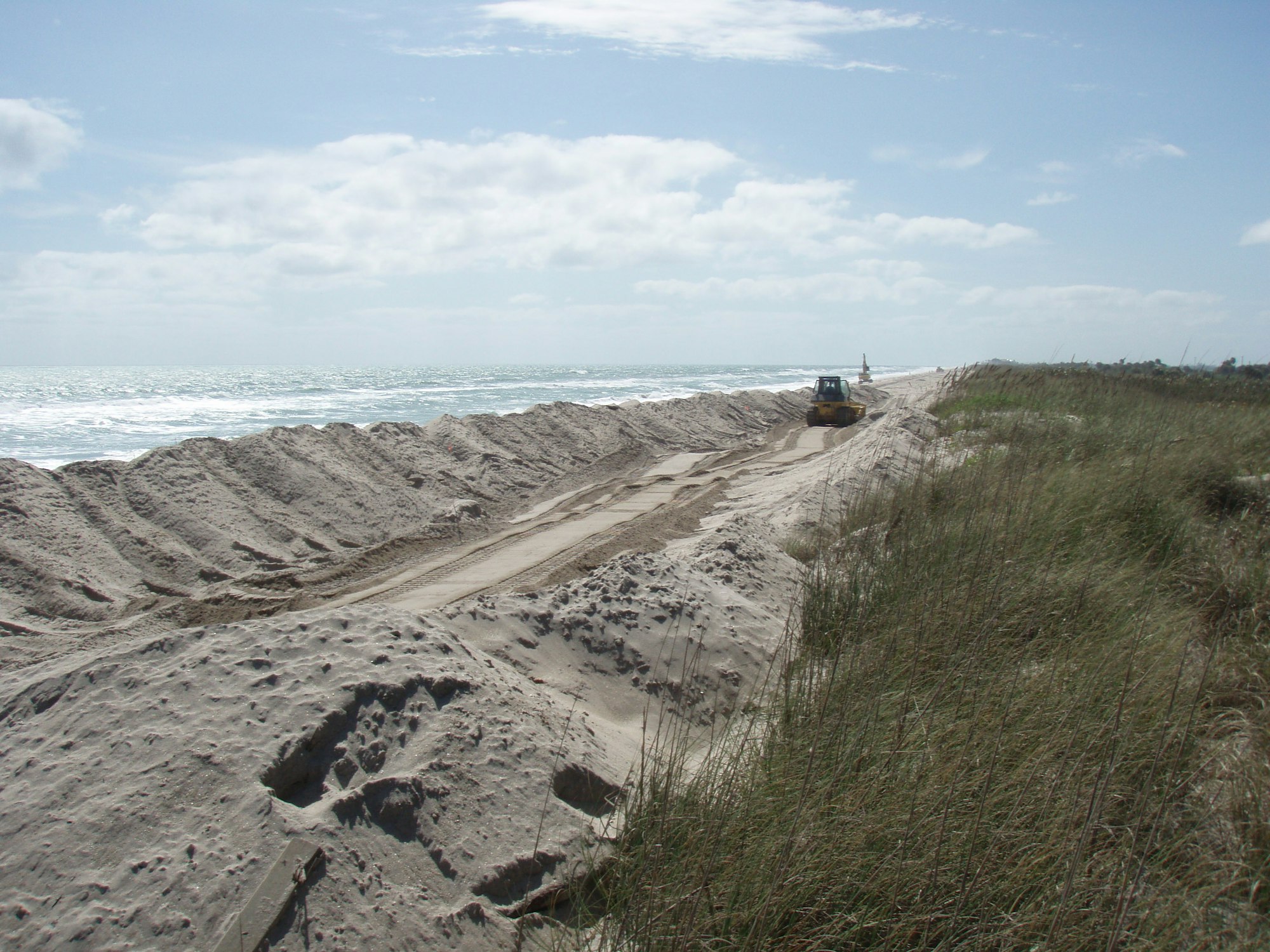
In 2010, the District partnered with Indian River County on a major beach renourishment project that placed 267,182 cubic yards of sand from upland sand mines on beaches South of the inlet.
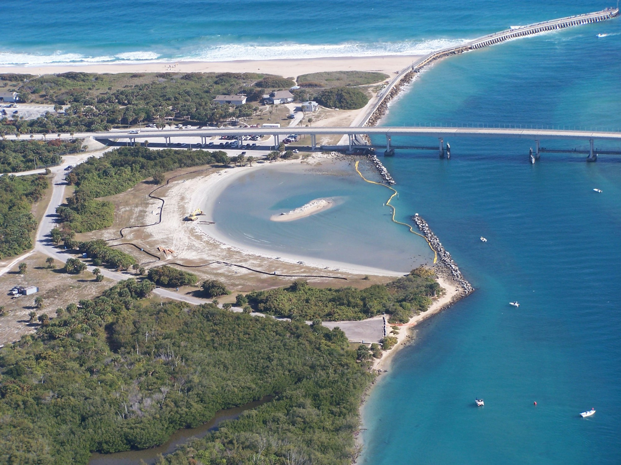
In 2010, the District partnered with the Sebastian Inlet State Park to restore the tide pool and build the District’s Dredged Material Management Area (DMMA).
Over 10,000 cubic yards of sand were removed from the popular tide pool area which had filled in so much over the preceding 20 years that the water was only ankle deep at low tide.
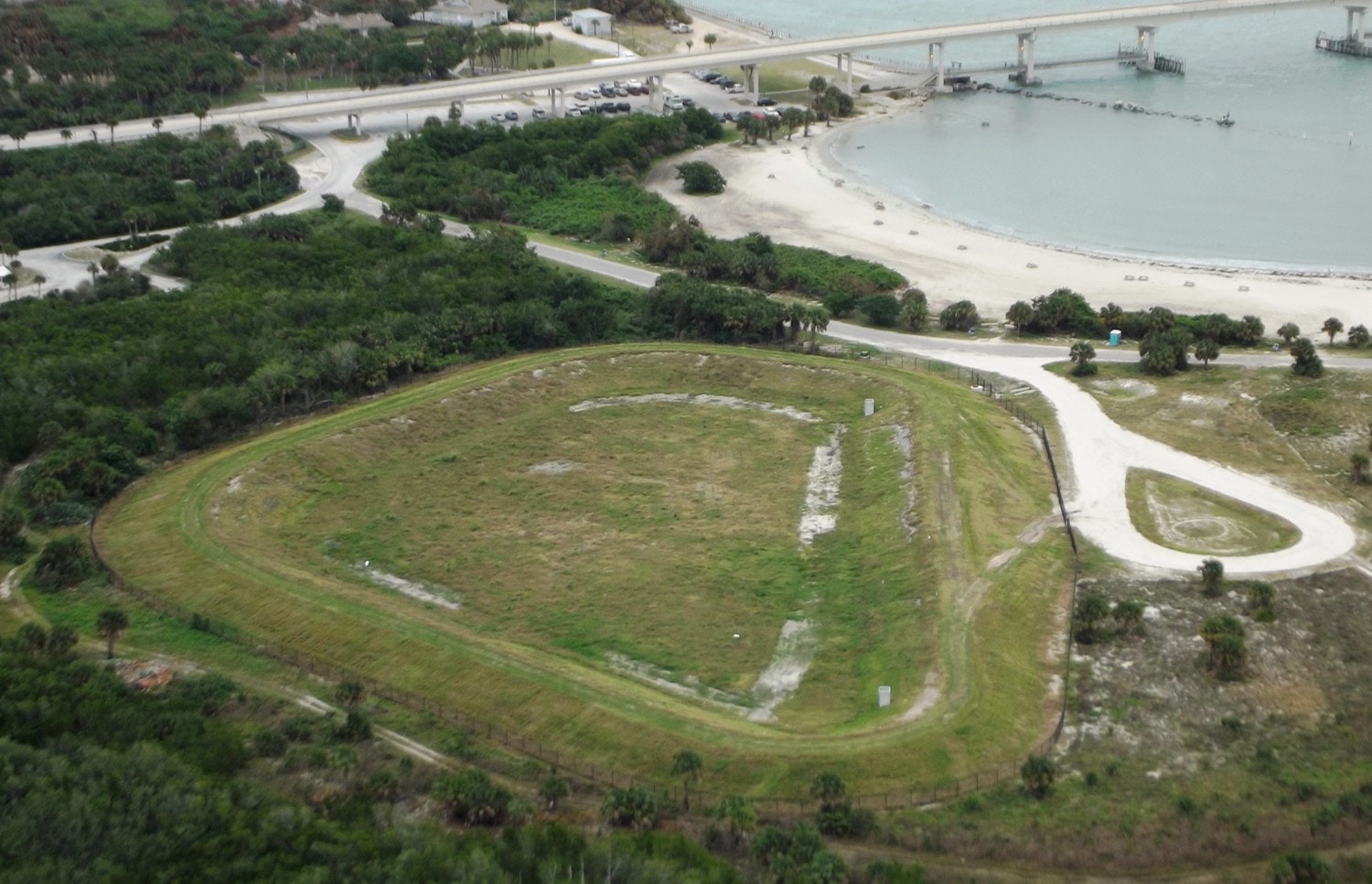
The 6-acre DMMA with 14-foot high berms allowed for the District to stockpile a minimum of 30,000 cubic yards sand for emergency dune and beach repair.
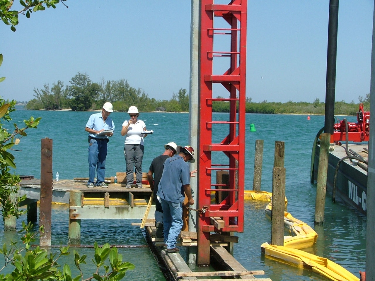
In 2011, the District secures a total of $173,000 cost share funding from Florida Inland Navigation District to complete two projects. First, construction of the new T-dock to replace the old, failing L-dock once known as Henry’s dock.

Second, the Coconut Point restoration on the South side of the inlet. Coconut Point lost more than 200 feet in 5 years to wind-related erosion and the project to stabilize the tip was completed in 2012.

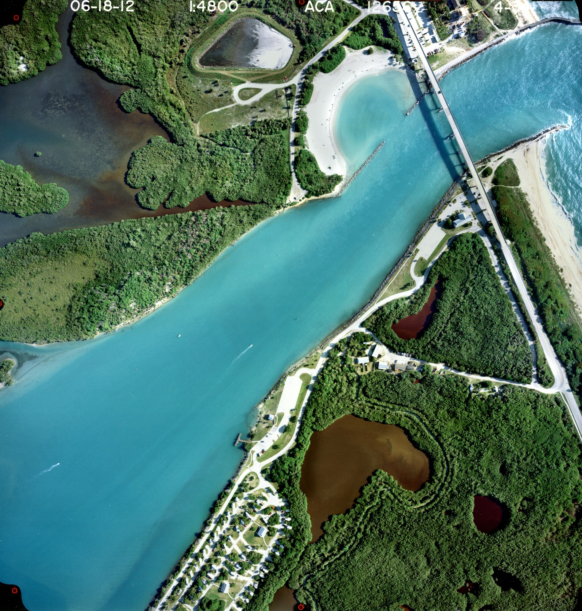
In 2012, the District dredged its Sand Trap, extracting 122,000 cubic yards of beach quality sand for beach placement and storage in the DMMA. Shown here, aerials from 2012.
On October 26, 2012, the eye of Hurricane Sandy passed within 200 miles of the Sebastian Inlet with waves ranging from 20-30 feet offshore, and producing over 10-foot breaking waves on local beaches causing moderate to major dune erosion.

In December, the District received authorization for emergency dune repair between Florida Department of Environmental Protection (FDEP) R-monuments or beach markers R-8 to R-17.

In 2013, Cardno ENTRIX economists valued the economic benefits of Sebastian Inlet at $200M annually.
In 2014, the Orion Marine Group was awarded the bid for the sand trap dredging, excavation and expansion project.

More than 111,000 cubic yards of sand was placed on beaches to the South and 50,000 cubic yards of coquina rock removed to increase capacity. The now 42-acre Sand Trap would take longer to fill with sand, extending the timeframe for dredging and beach renourishment to 4-5 years.
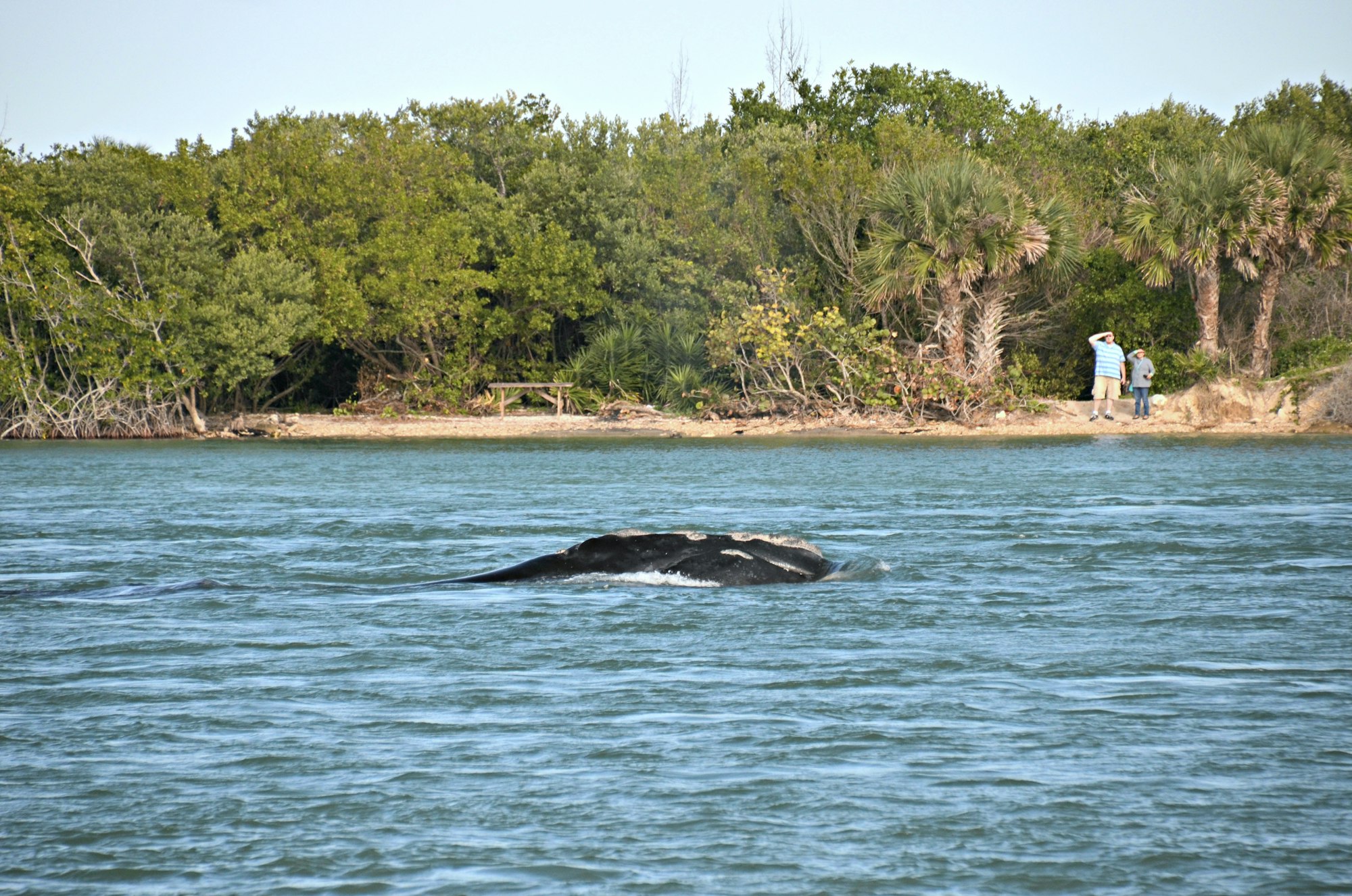
In February 2016, an endangered North Atlantic Right Whale named “Clipper” and her calf spent 29 hours in Sebastian Inlet as amazed onlookers snapped photos and Florida Fish and Wildlife Conservation Commission officers kept boaters at a safe distance.
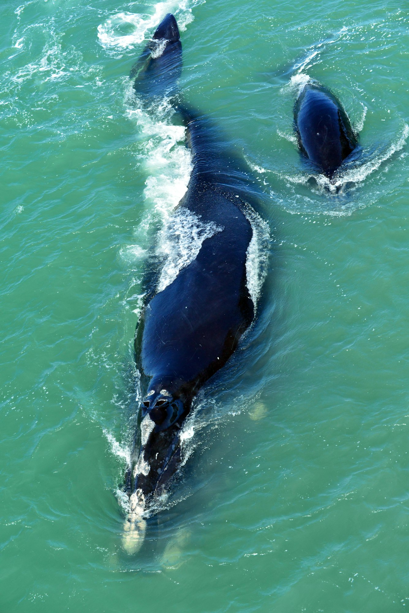
The mother whale was about 45-feet long, and the calf about 18-feet. Both were able to exit the inlet on their own – a happy ending to this remarkable event!
.jpg?ixlib=rb-1.1.0&w=2000&h=2000&fit=max&or=0&s=3fc02f3e07d02361b642d995a2f183d4)
In 2018, the District issued a competitive request for bids for its first sand trap dredging and beach renourishment project since expanding the sand trap in 2014. Work began in January of 2019.
The channel maintenance dredging, sand bypass and beach renourishment project dredged the inlet’s 42-acre sand trap and navigational channel connecting the inlet to the Intracoastal Waterway.

During phase I, approximately 113,000 cubic yards of sand was placed on downdrift beaches on a 1½ mile stretch of beach South of the Sebastian Inlet starting at McLarty Treasure Museum and continuing South past the Ambersand beach access.
Phase II stockpiled more than 50,000 cubic yards in the District’s Dredged Material Management Area (DMMA) for future emergency beach fill and dune repair.

Total project cost was approximately $3M and 75% of the project was covered by FDEP state funds with the remaining 25% paid by the Sebastian Inlet District.
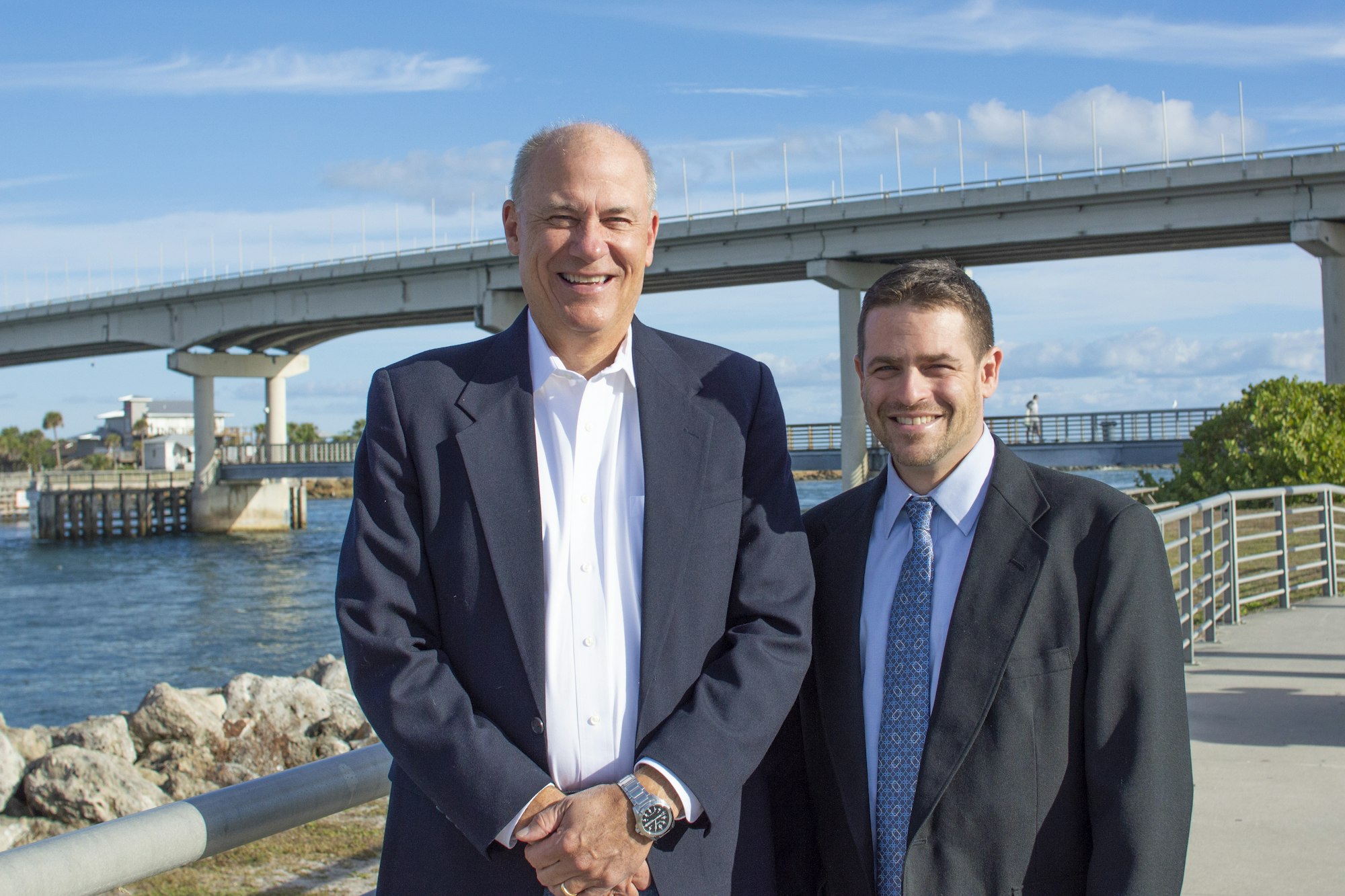
In 2019, Martin Smithson retires after 15 years of service to the District having reached numerous milestones. James Gray, Jr. would be selected by the Commission as his successor.
We're still capturing Sebastian Inlet history. Here, we share some of our favorite images taken since 2021.
Labor Day, 2021
South Jetty, September 29, 2021

Shutterbugs shooting ospreys in flight, October 6, 2021
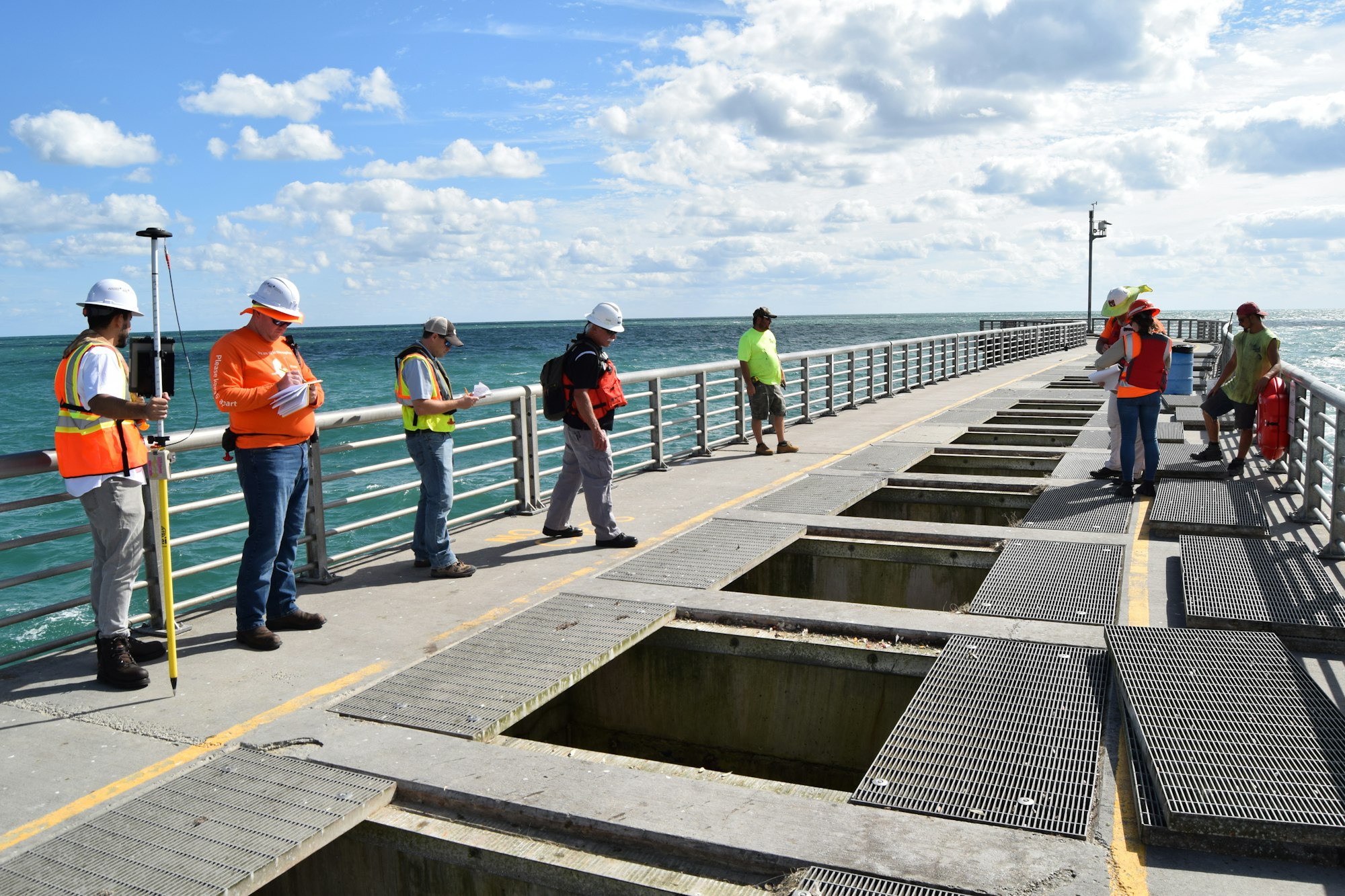
North Jetty inspection, October 19, 2021
An open grate at the North Jetty during a biennial inspection, October 19, 2021 2021
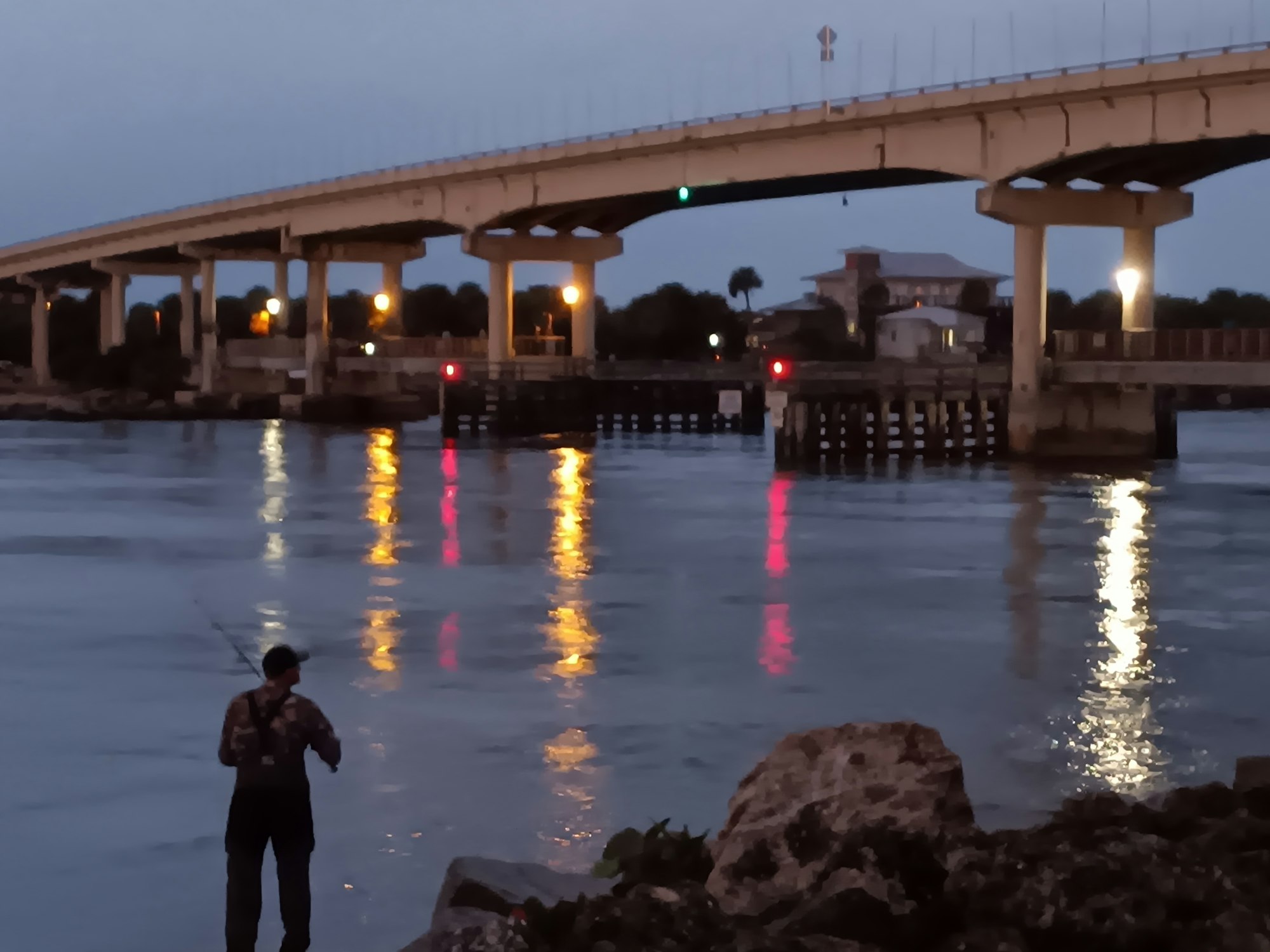
Evening descends on the inlet, looking northeast from the south side, November 10, 2021

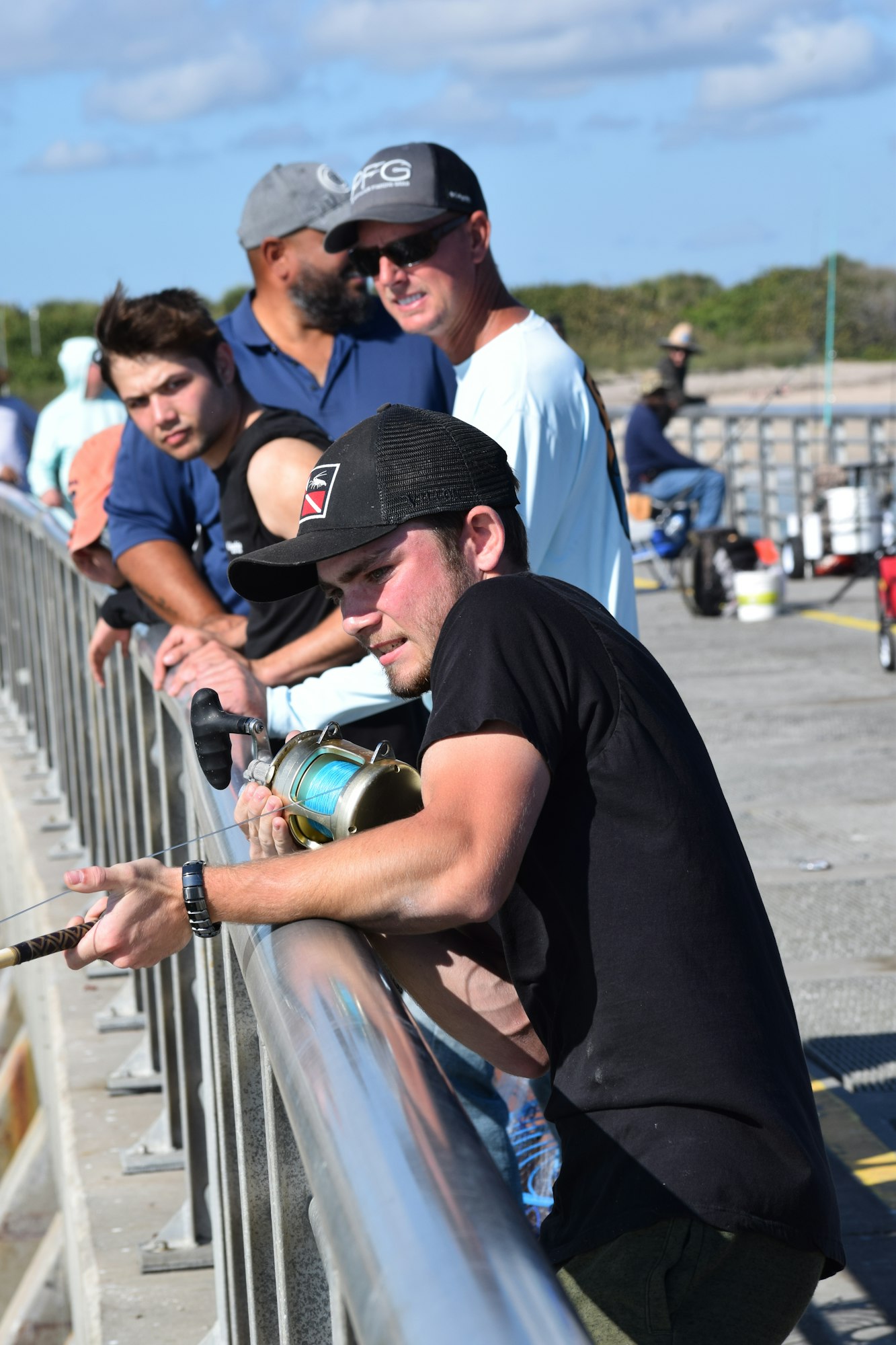
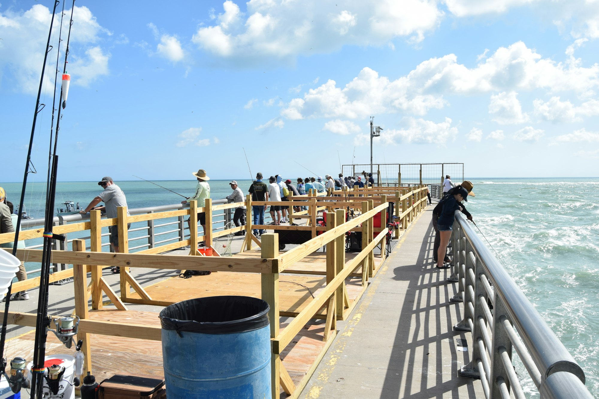
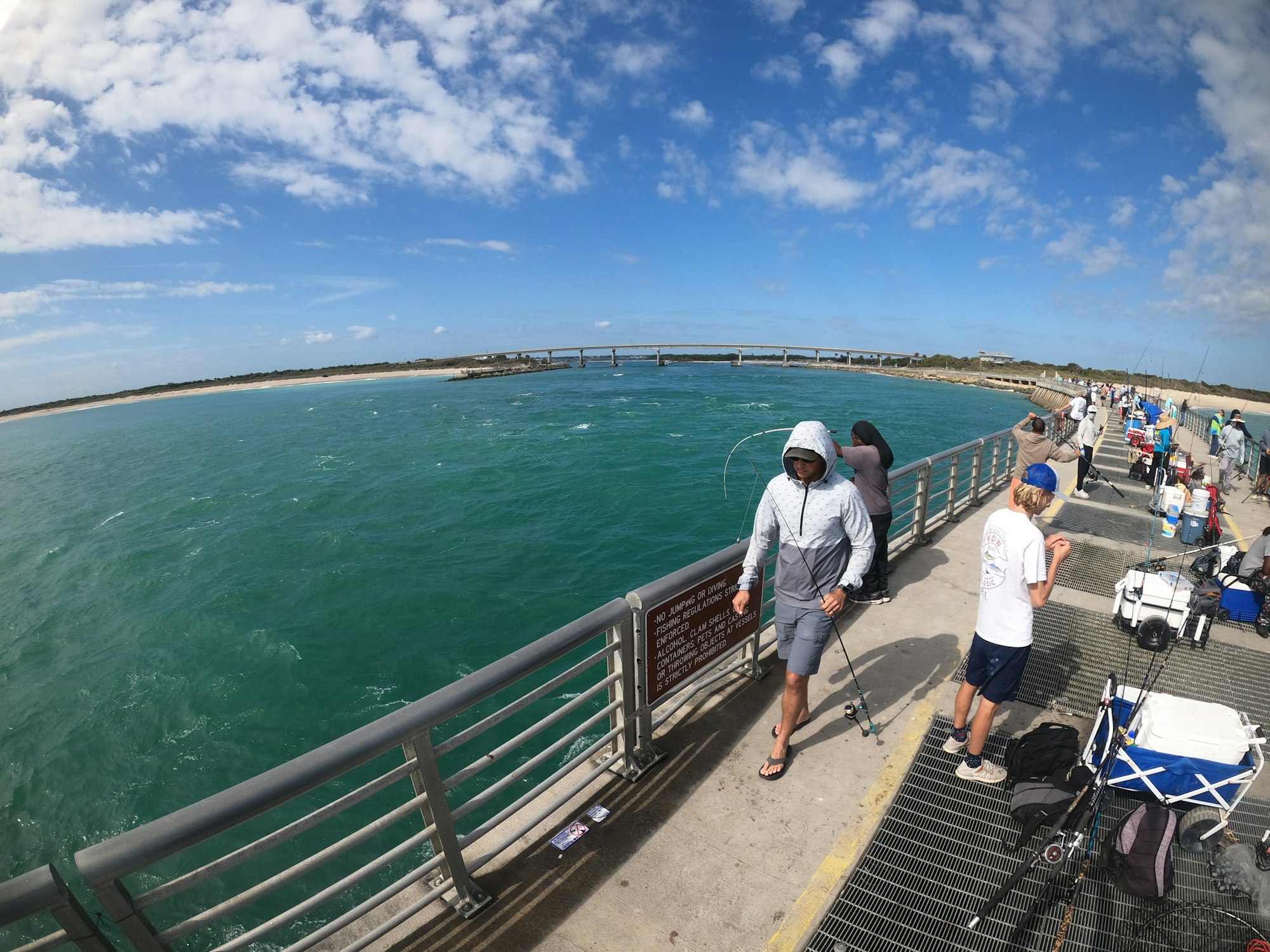
Throngs of anglers at the North Jetty, December 9, 2021
Tyler Grove of Melbourne almost lands a goliath grouper, but the line breaks, December 29, 2021
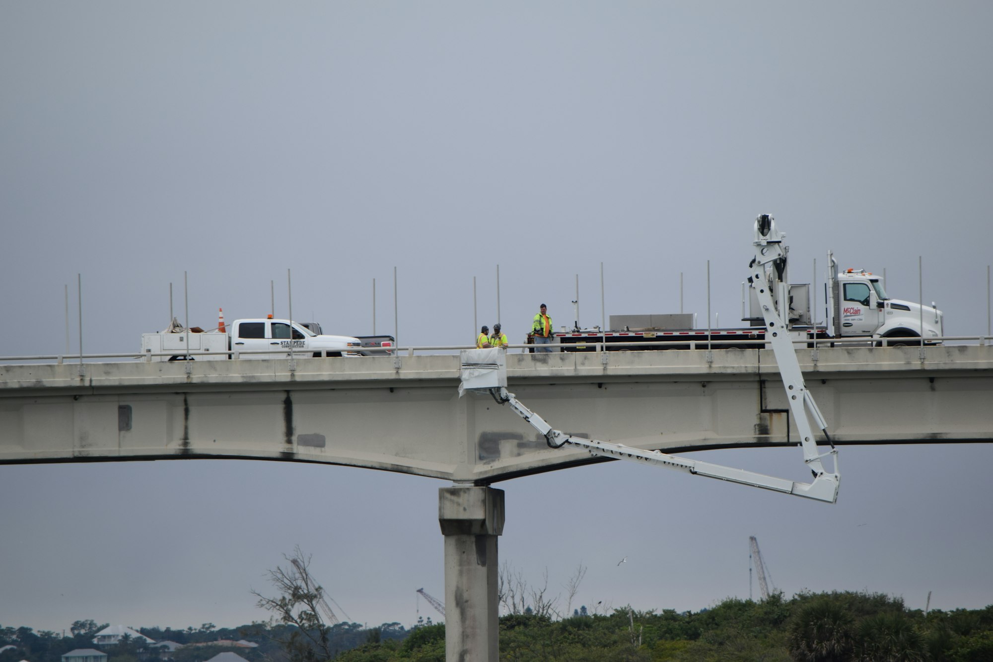
Florida Department of Transportation conducting work on the inlet bridge, January 28, 2022
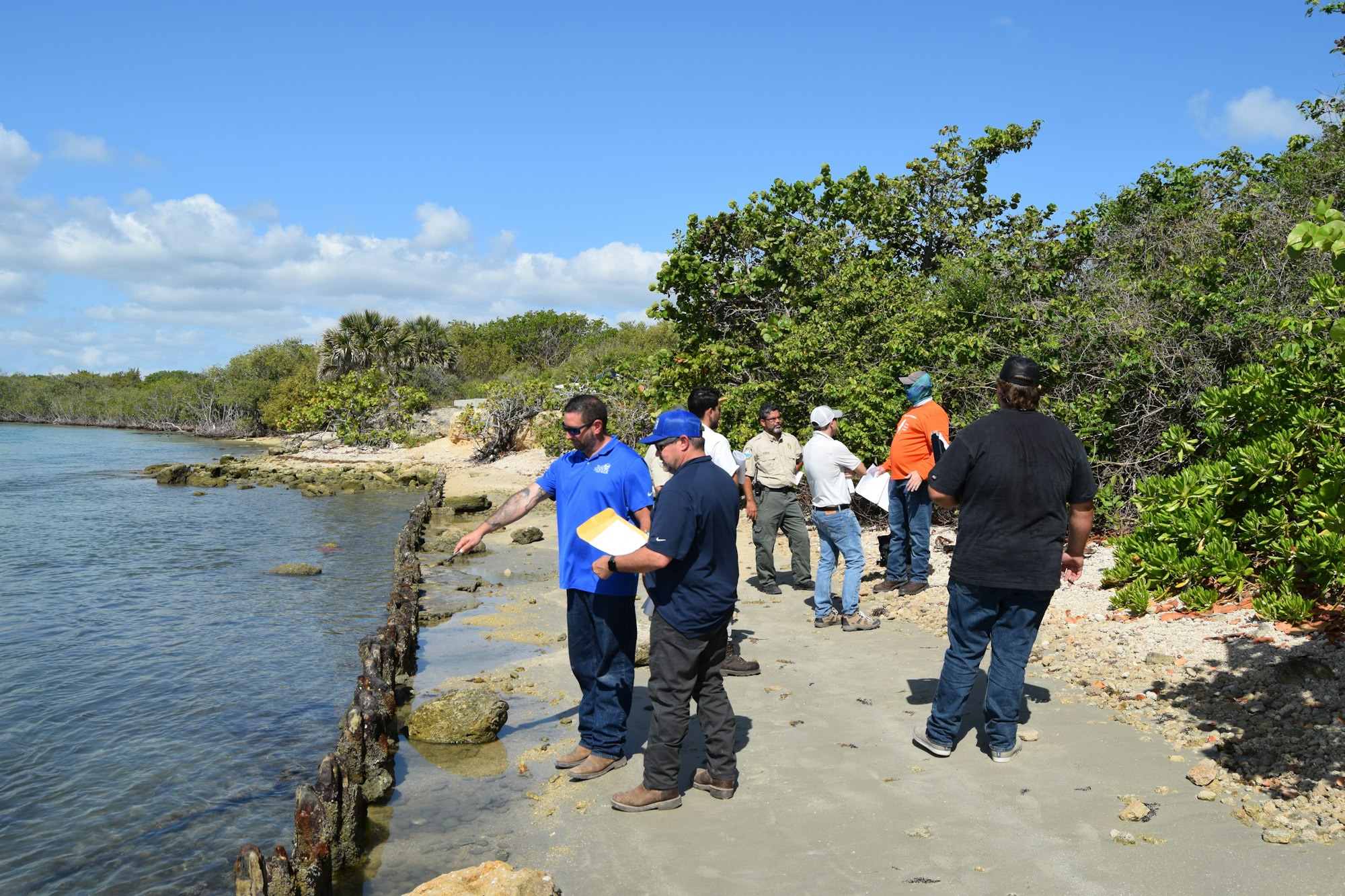
Pre-construction meeting on April 26, 2022 in preparation for a $1.1 million shoreline stabilization project on the north and south shore of the inlet channel.
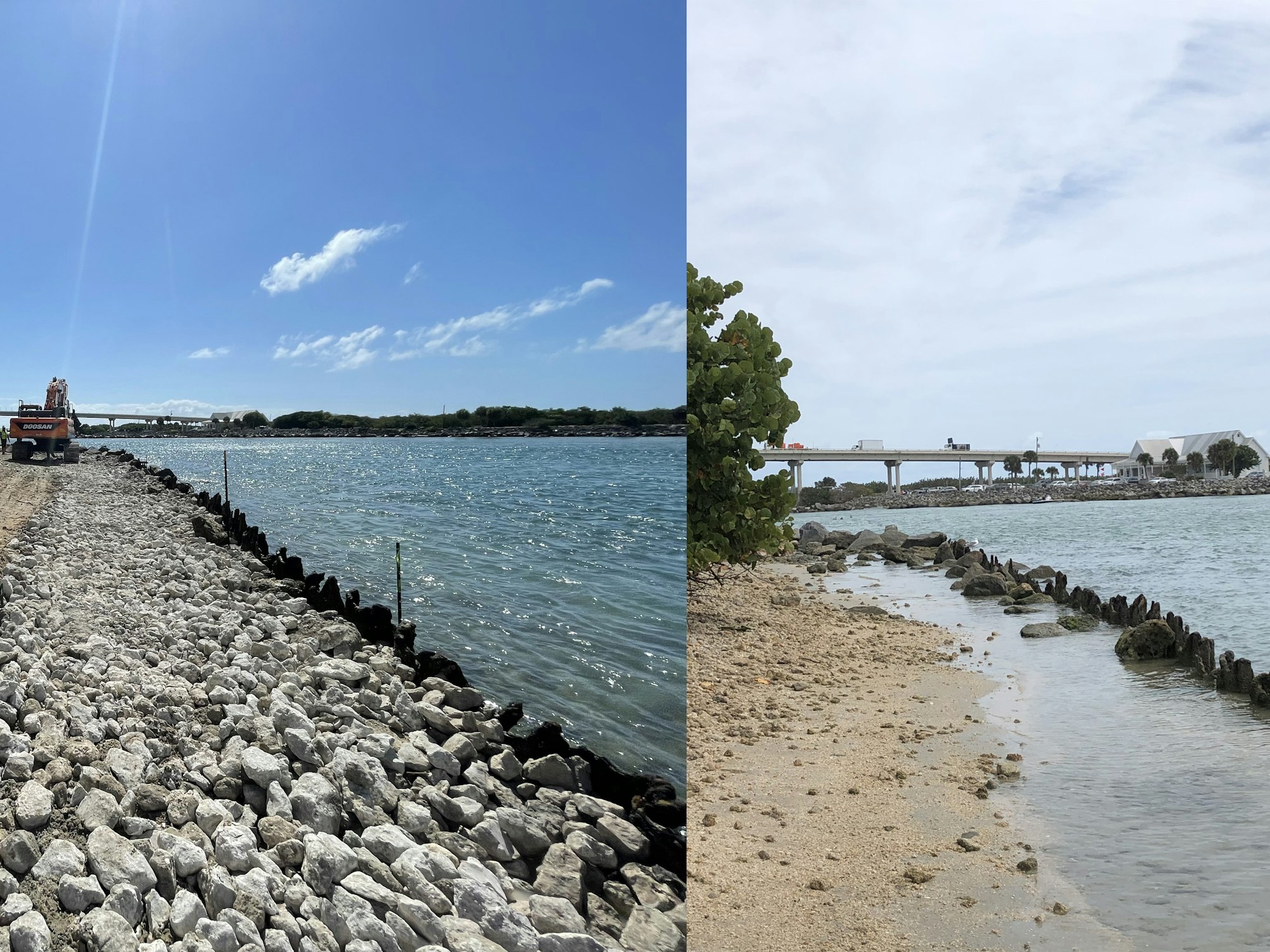
Progress on the North Shoreline Rehabilitation Project, May 24, 2022
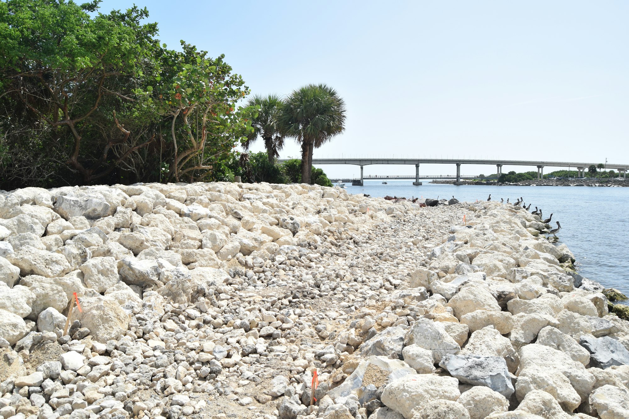
Final stages of North Shoreline Rehabilitation Project, July 19, 2022
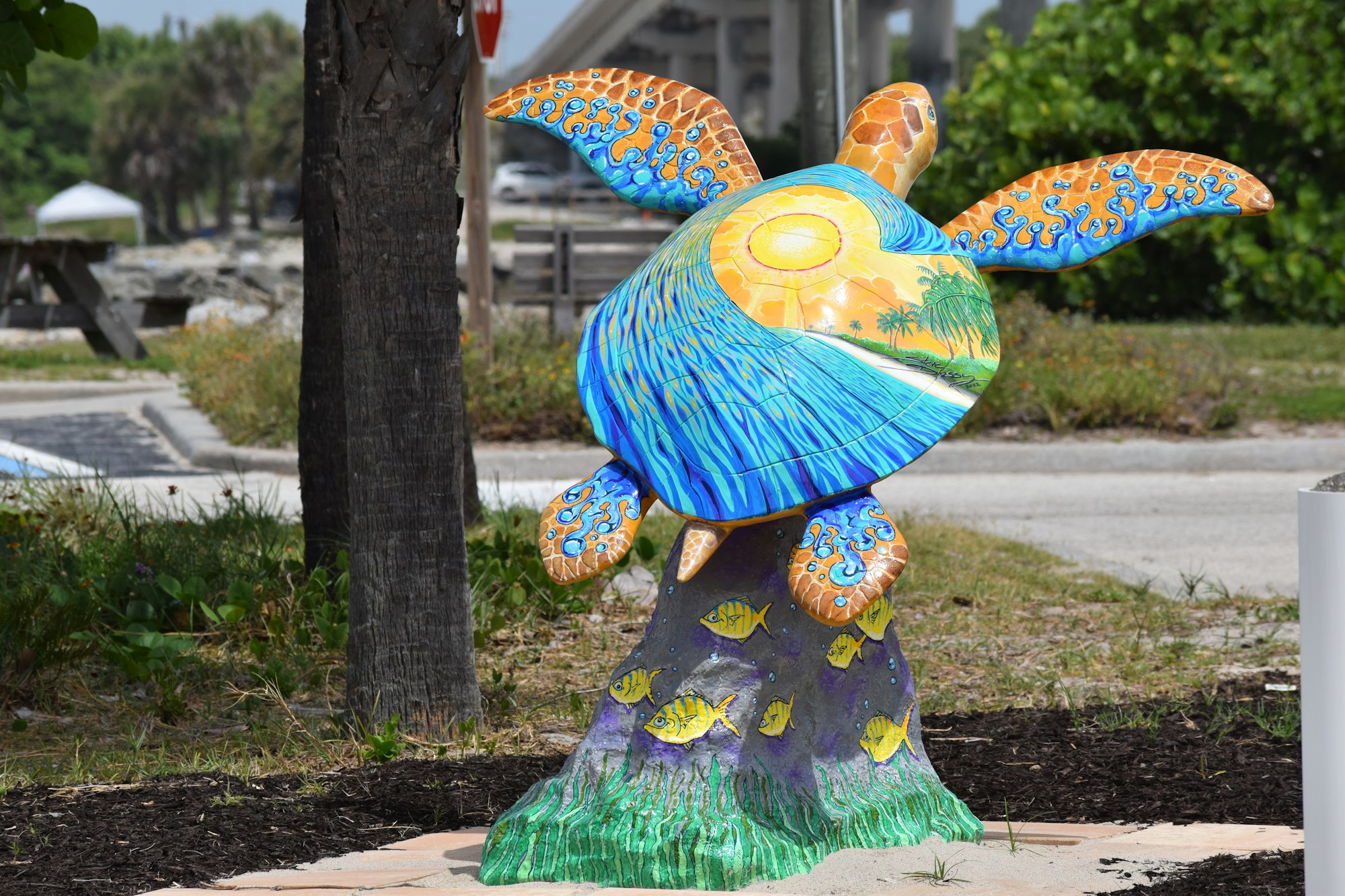
Turtle statue at south entrance, August 2022
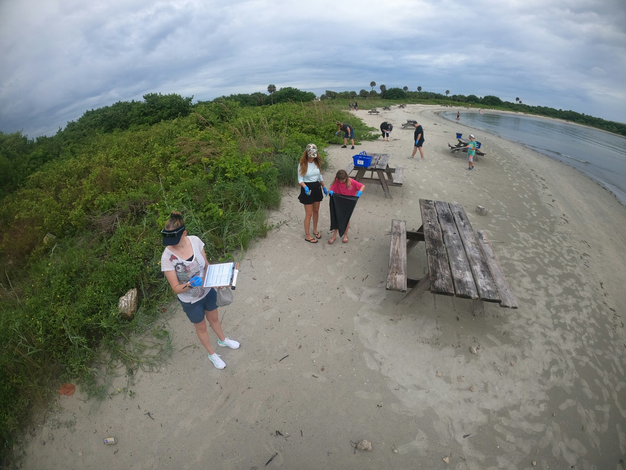
Coastal Cleanup event, September 19, 2022
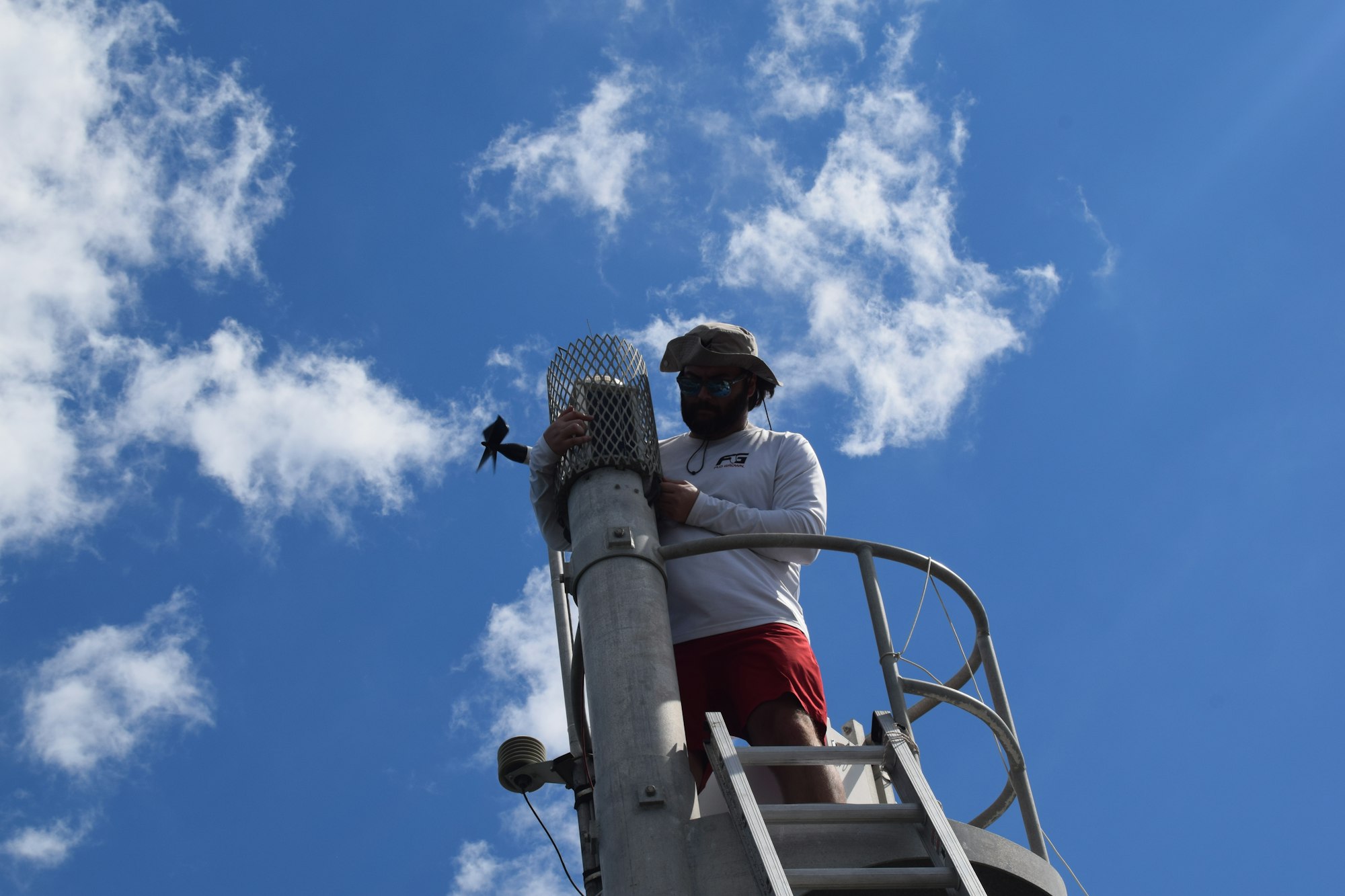
Replacing the north jetty signal with an upgraded LED model, October 7, 2022
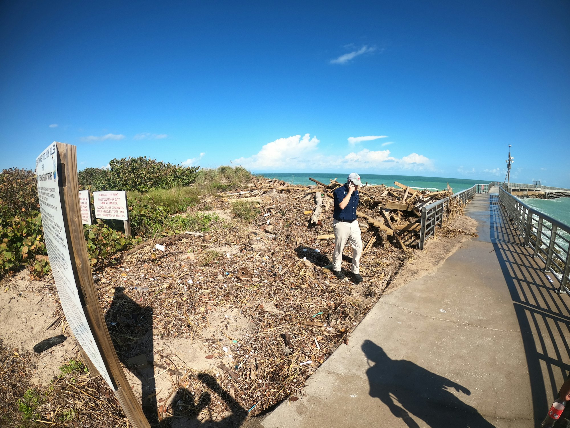
District Executive Director James Gray inspects damage from Hurricane Nicole, 2022,
Repairing the splash apron from hurricane damage, December 2022
Temporary north jetty repairs in the wake of Hurricane Nicole, February 17, 2023
Law enforcement cleanup event, April 26, 2023

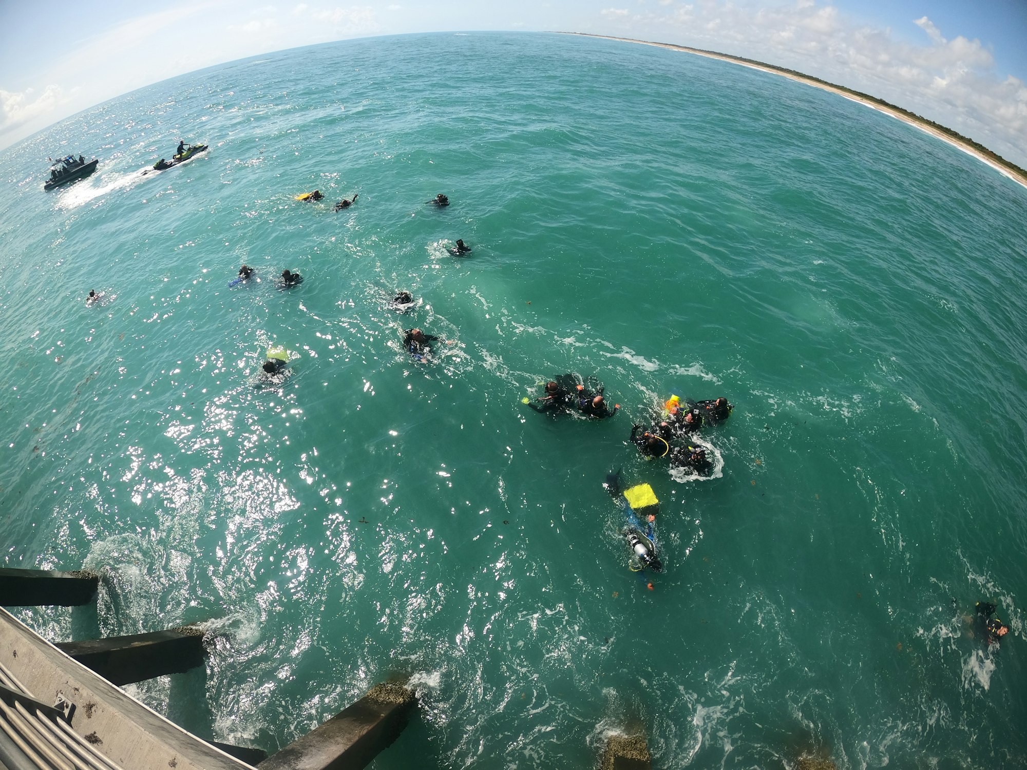
Sebastian Inlet District staff member Ed Garland and Sebastian Inlet State Park Manager Ken Torres launch a new kayak used for trash cleanups and underwater photography, June 2023.
North jetty, July 21, 2023. Replacement of grates lost during the 2022 hurricane season still incomplete.
.JPG?ixlib=rb-1.1.0&w=2000&h=2000&fit=max&or=0&s=2468a49d3cbcdaecb5e004a42b8a68d6)
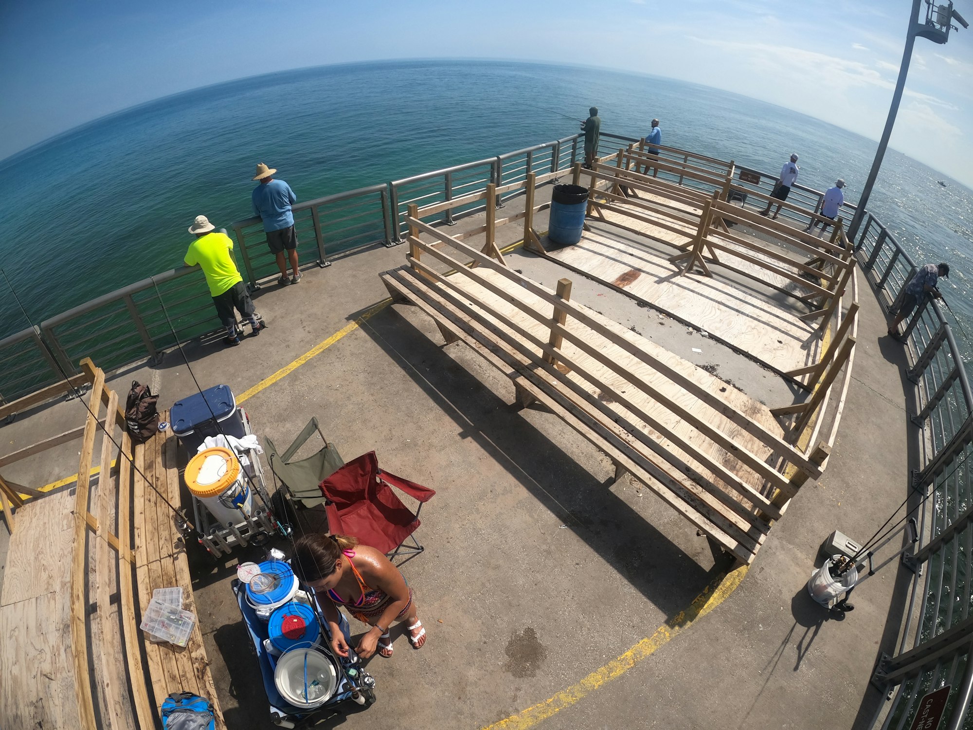
Fisheye lens view looking east from the T-dock on the south side, August 2023

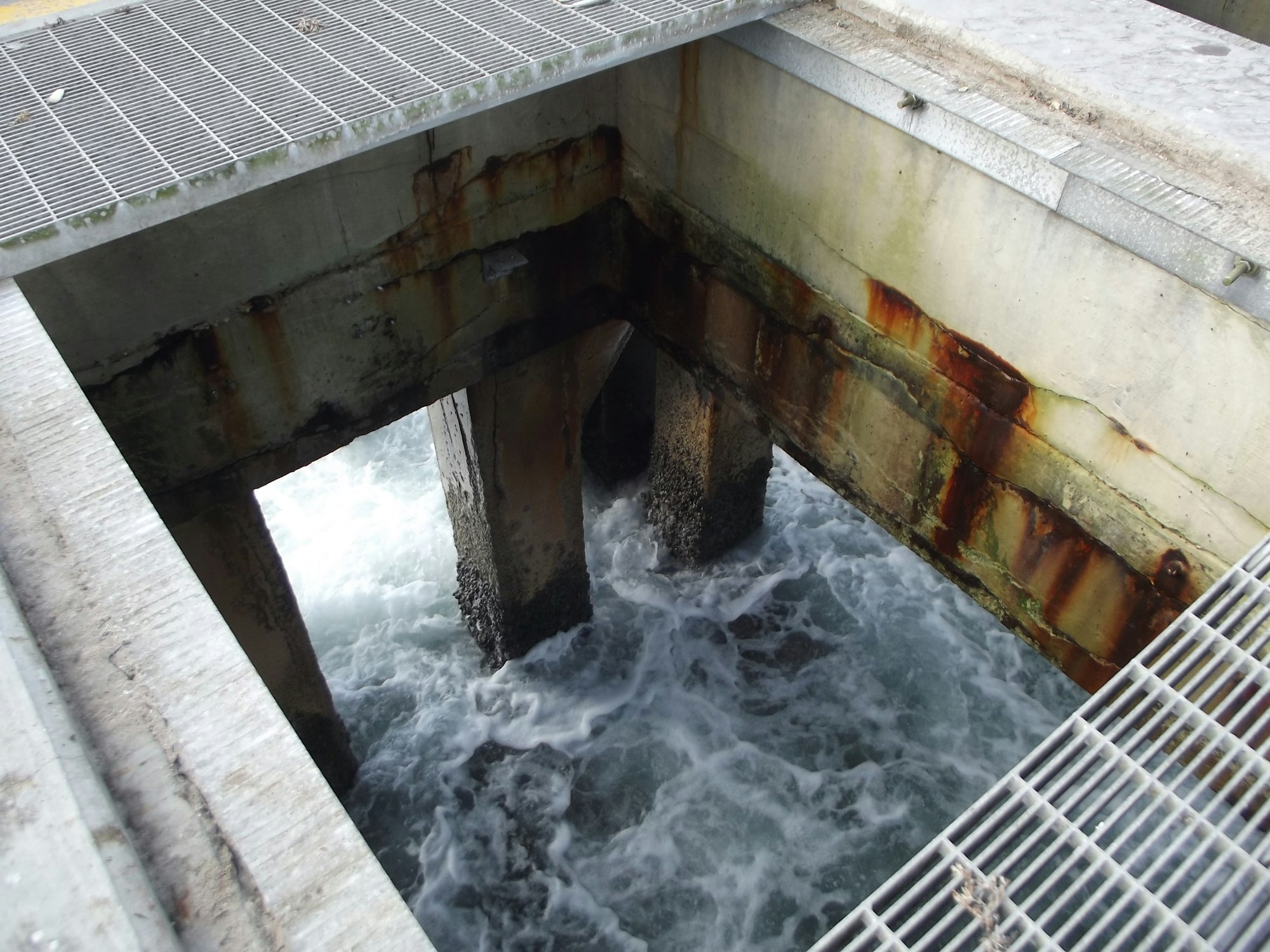
Eroded section beneath North jetty walkway awaiting repair, December 2023
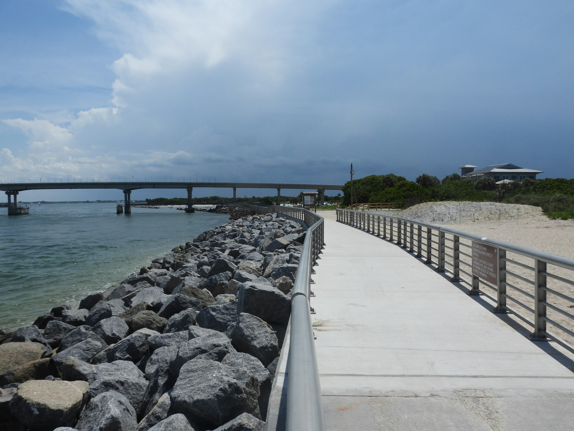
A view of the north jetty on March 21, 2024.

Work begins on the 2024/25 North Jetty Revetment Improvements Project – Phase 1 . November 2024.
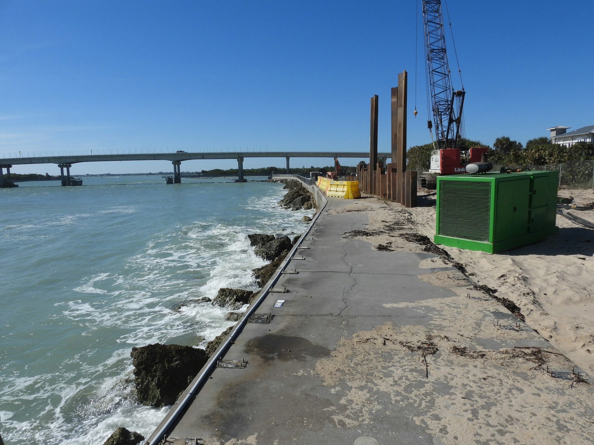
The North Jetty project called for repairing 210 feet of the structure by adding a sheet pile seawall, granite boulders and a new sidewalk. November 2024
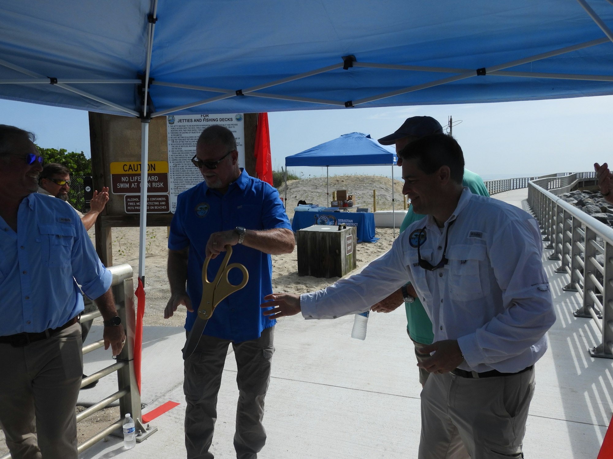
District Chairman David Barney cuts the ribbon to mark the June 30, 2025,reopening of the North Jetty Revetment Improvements Project - Phase 1.
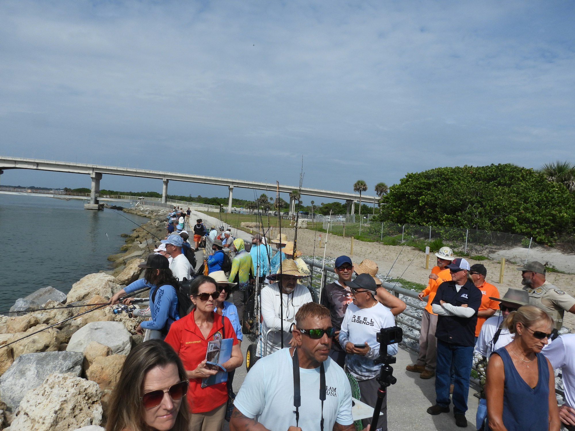
On June 30, 2025 crowds await the reopening of the north jetty.
The completed North Jetty Revetment Improvements Project, Phase 1, as it appeared in July 2025

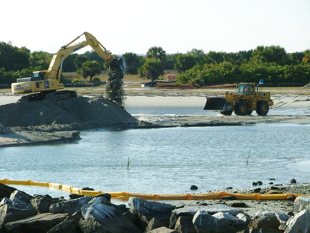
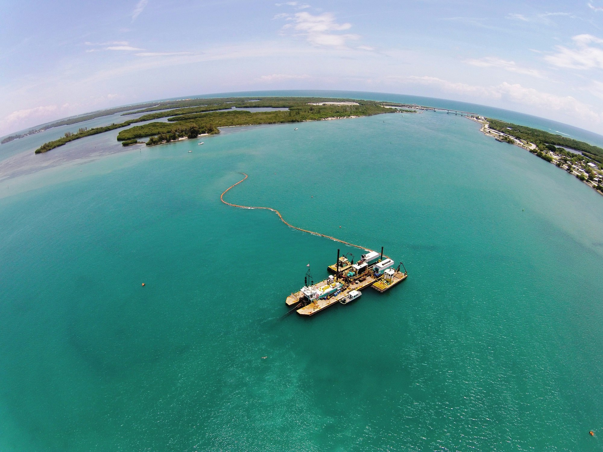
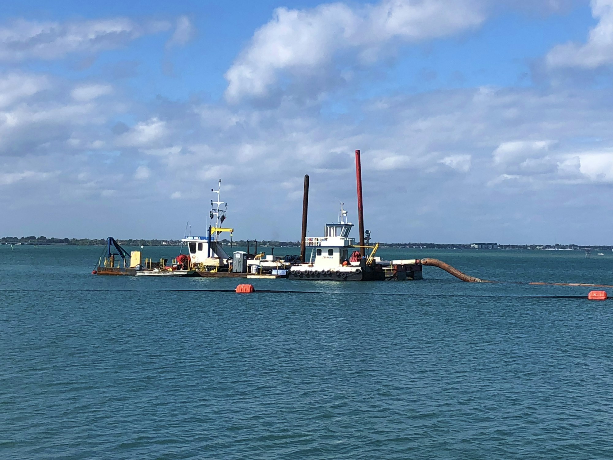
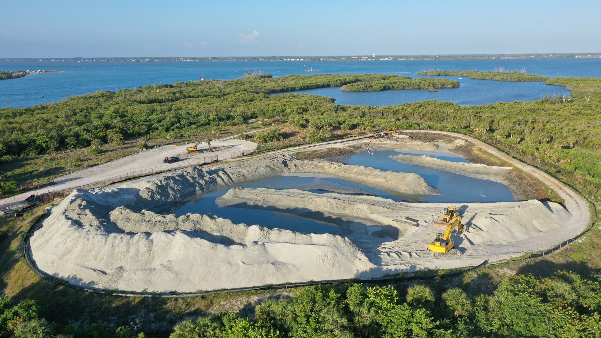
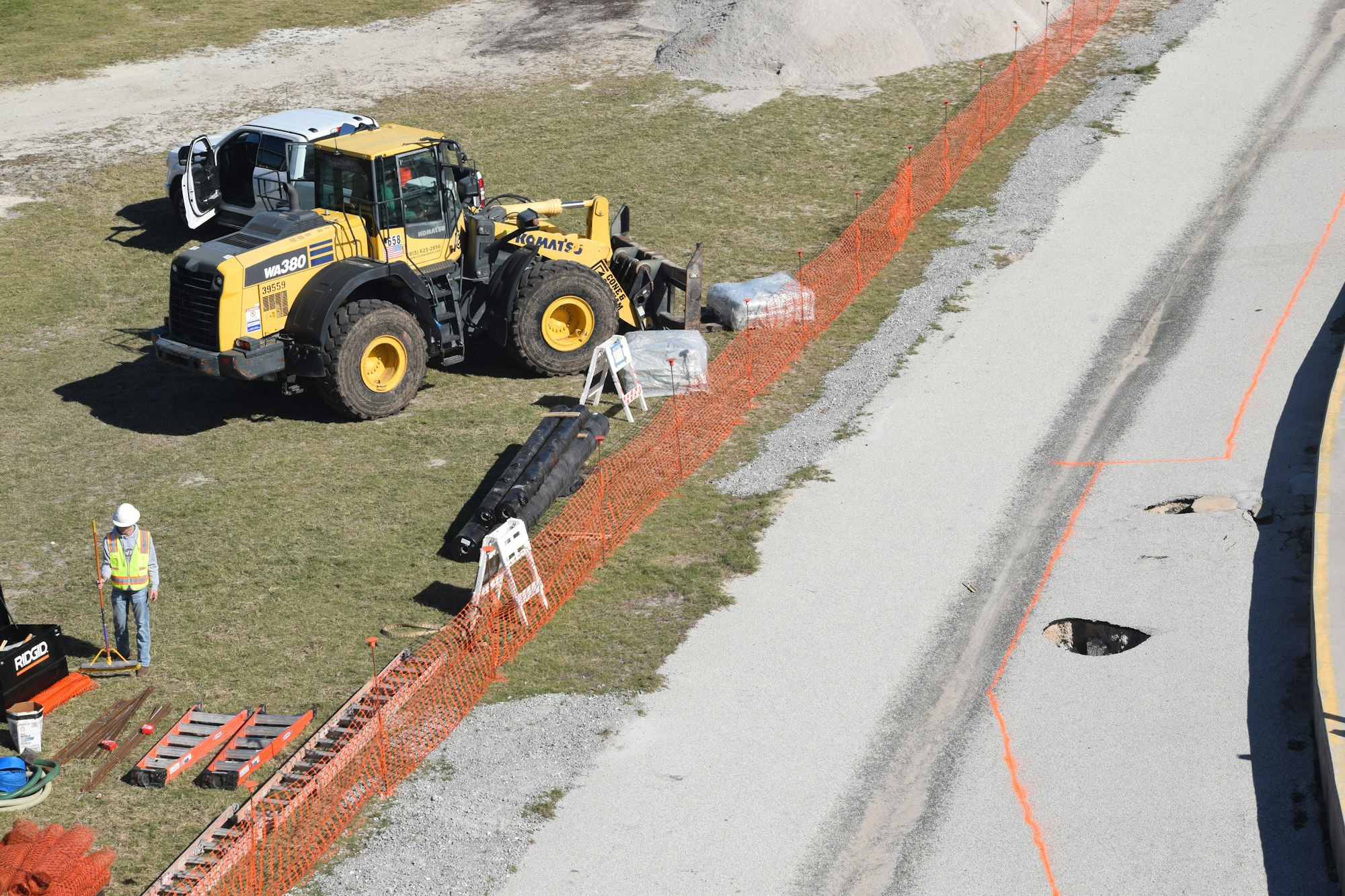
The 25-26 dredging and beach placement project. Dredged sand is pumped into the containment area in December 2025.

The Sebastian Inlet District Commission tours the 2025-26 dredging project containment site in January 2026.

April 2026: The 2025-26 dredging and sand placement project is complete, with approximately 130,000 cubic yards placed on the south beaches and in the DMMA.

.jpg?ixlib=rb-1.1.0&w=2000&h=2000&fit=max&or=0&s=386b54c352044d178d6b5f6b9cbd2953)


.jpg?ixlib=rb-1.1.0&w=2000&h=2000&fit=max&or=0&s=24424963eb93ee60ac0a31e1d8f8a137)
.jpg?ixlib=rb-1.1.0&w=2000&h=2000&fit=max&or=0&s=f857dc91f6ea2692a8dfd1518a77cd33)